Multiple Rounds of Severe Storms Threaten Northeast

NEW YORK - Numerous tornado-warned storms moves through New York and Pennsylvania late Wednesday evening, causing scenes like you see above in Avon, NY. Winds were reported up to 76 mph in the city of Seneca Falls, New York and hail was reported up to 2" in Michigan.
Through the overnight hours, the SPC has maintained a severe weather outlook for western New York, Pennsylvania and eastbound. This is a level 2, SLIGHT, risk for severe weather.
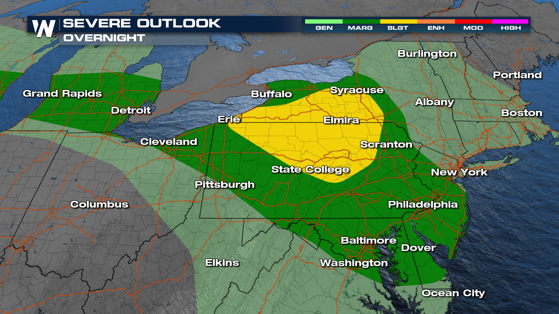
Damaging wind gusts will be the primary concern, with some storms capable of knocking down trees and power lines. Large hail will also be possible, and a few tornadoes cannot be ruled out.
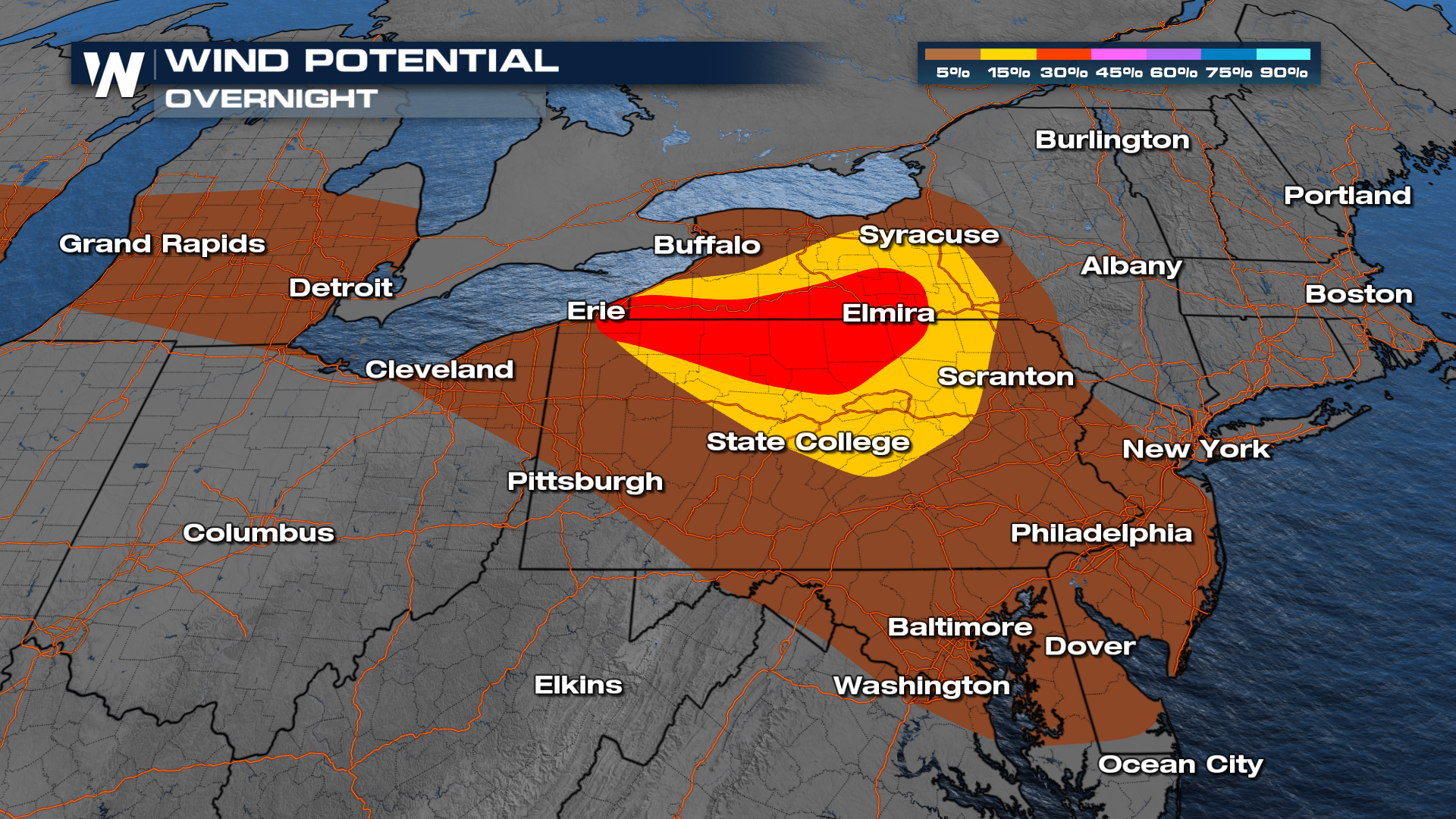
The severe-weather threat stretches from portions of the eastern Great Lakes through the Northeast and into the Mid-Atlantic.
Heavy Rainfall Raises Flash-Flooding Concerns
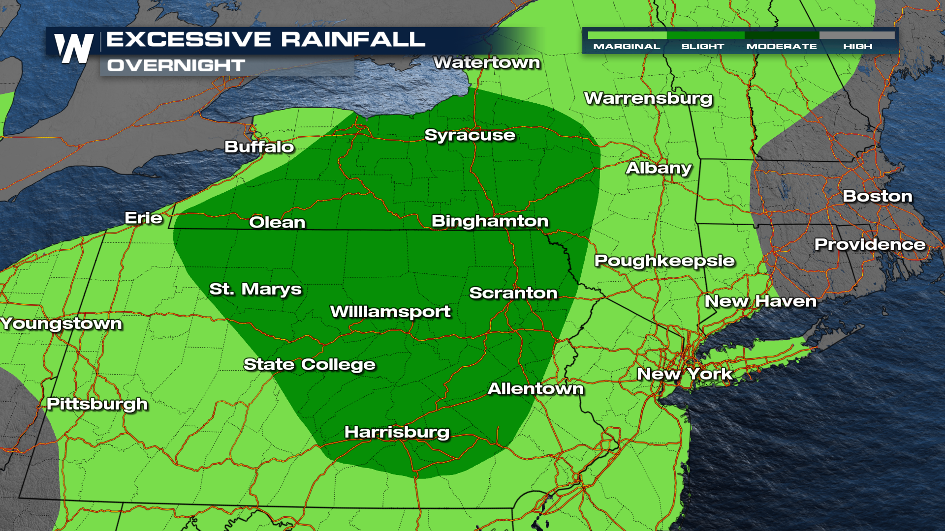
Repeated rounds of storms have led to swollen riverways in areas around the Midwest, like Indiana, in the past week. This week, the concern is more centered around flash flooding, when it simply rains too hard for too long. Portions of New York, Pennsylvania, and New Jersey look to see some of the heavier rain totals over the next few days.
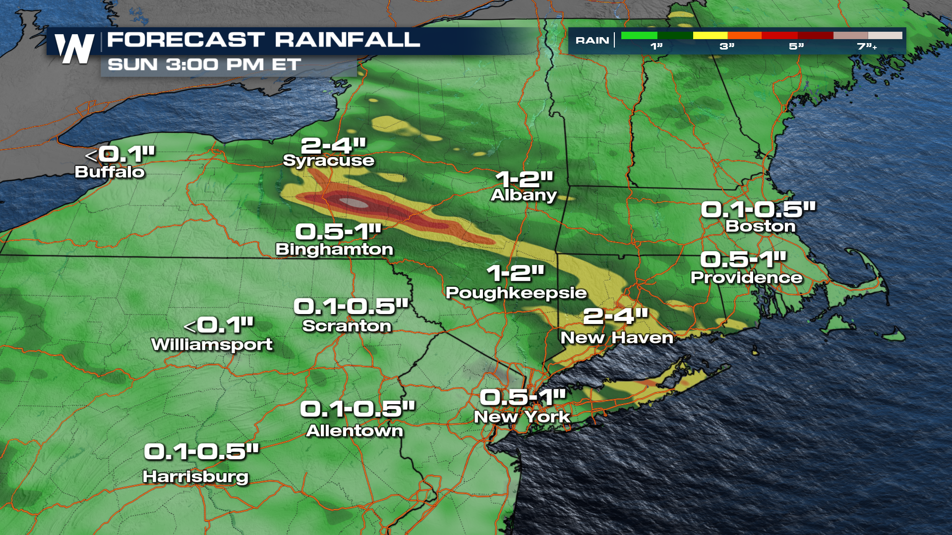
Cities like New York, Poughkeepsie, and Syracuse in New York State should stay vigilant of the flooding potential. This is especially true considering the heavy rainfall we have seen here over the last several weeks.
Severe Threat Shifts South Thursday
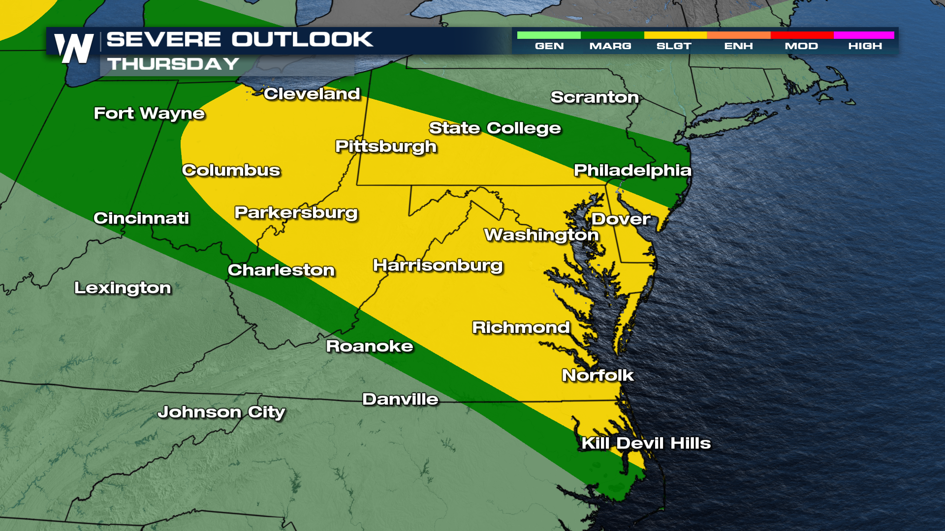
The unsettled pattern will continue Thursday as another round of thunderstorms develops from portions of the Ohio Valley toward the Mid-Atlantic. The latest Storm Prediction Center outlook includes a SLIGHT risk (level 2 out of 5) for parts of this corridor, with scattered storms capable of producing damaging winds. Some storms farther west could also produce large hail.
 Storms Continue into Friday
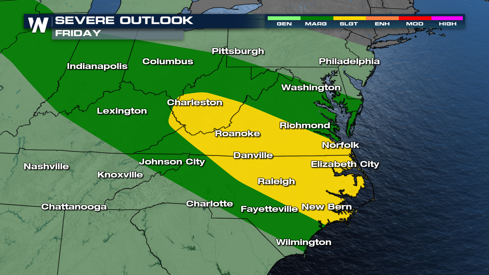
Another disturbance moving through the eastern U.S. could keep the severe-weather threat going Friday. The greatest risk is expected to shift farther into the southern Mid-Atlantic, where damaging wind gusts could once again be the main hazard. Some strong storms may eventually reach portions of the Carolinas.
By Saturday, the overall pattern should begin to change, although a lingering threat for strong or severe thunderstorms may remain across parts of the Carolinas. Residents from the Great Lakes to the Northeast, Mid-Atlantic and eventually the Carolinas should remain weather-aware over the next several days. With repeated rounds of thunderstorms possible, some communities could experience more than one episode of severe weather or flooding before conditions finally improve.
Storm Timing
Storms will continue overnight across New York and into more towards the Atlantic Coast so be prepared for some rumbles of thunder, gusty winds, and isolated tornadoes through Thursday. More rounds of thunderstorms will punch through into your Thursday and Friday with ample energy to support these severe weather hazards.
For more on the severe and flooding threat across the Northeast, tune in to WeatherNation :10 past the hour for your Eastern Regional Forecast.


