East Texas Still Vulnerable for Flooding After Edouard

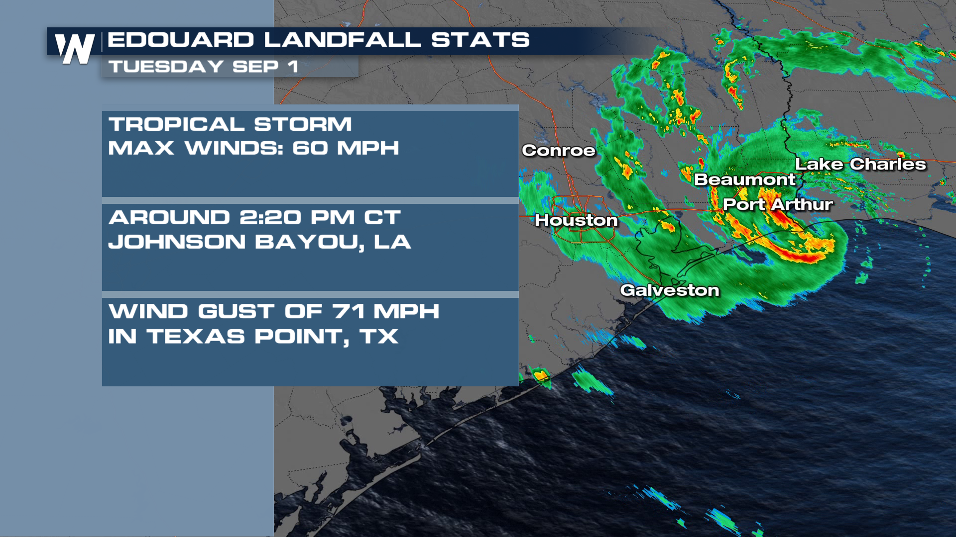
Tropical Storm Edouard made landfall along the northwestern Gulf Coast on Monday, September 1st. The National Hurricane Center used radar data from Lake Charles, LA and Houston, TX to determine maximum sustained winds of 60 mph as it moved ashore around 2:20 PM CT near Johnson Bayou, LA.
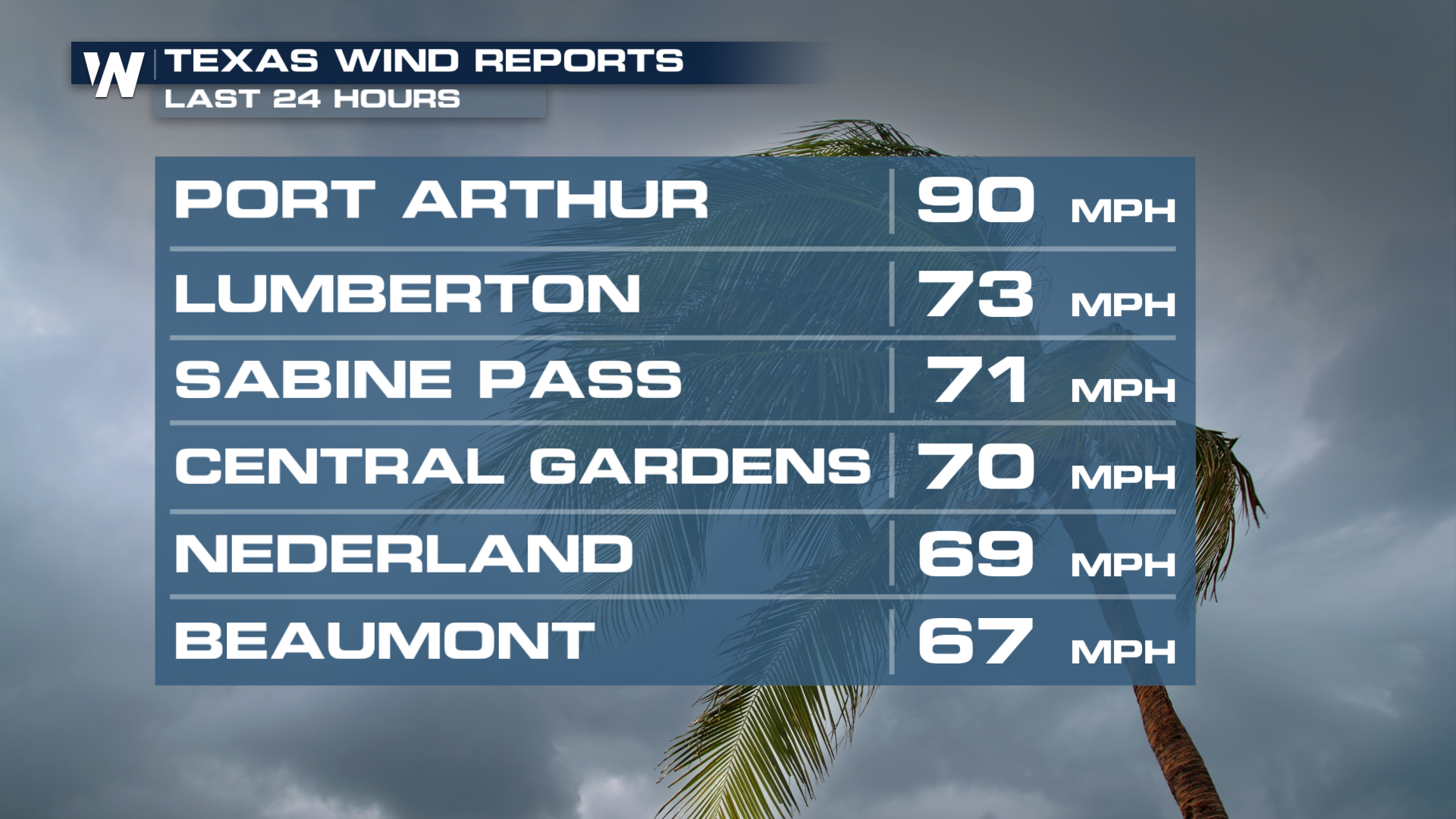
Wind speeds across portions of Texas peaked to 90 mph. Multiple areas saw wind speeds over 70 mph.
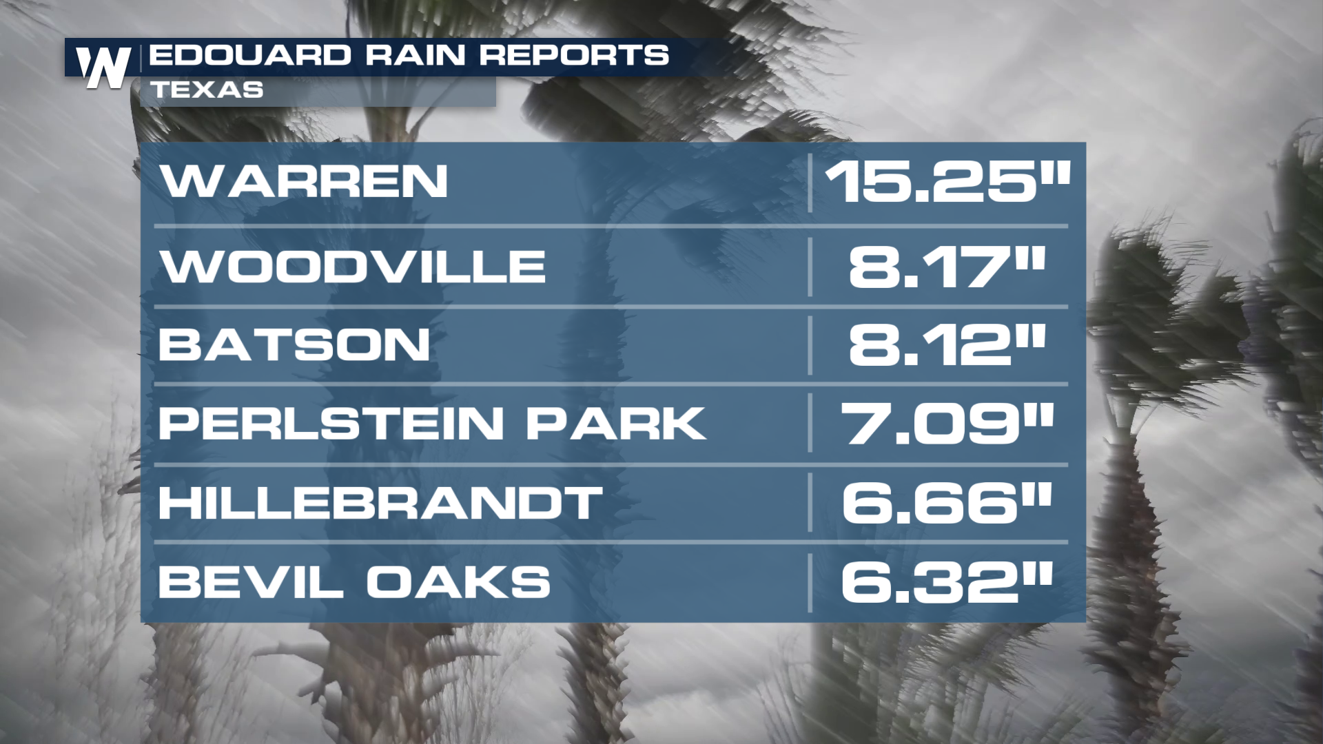
 Along with the strong winds, heavy rainfall has also been a big part of this storm system. Totals have peaked to nearly 16" in the last 24 hours for cities in Texas.
 Impacts Still Expected
Through the overnight hours, the Weather Prediction Center has maintained a HIGH risk for flash flooding. This is the highest level of out look you can get for flash flooding.
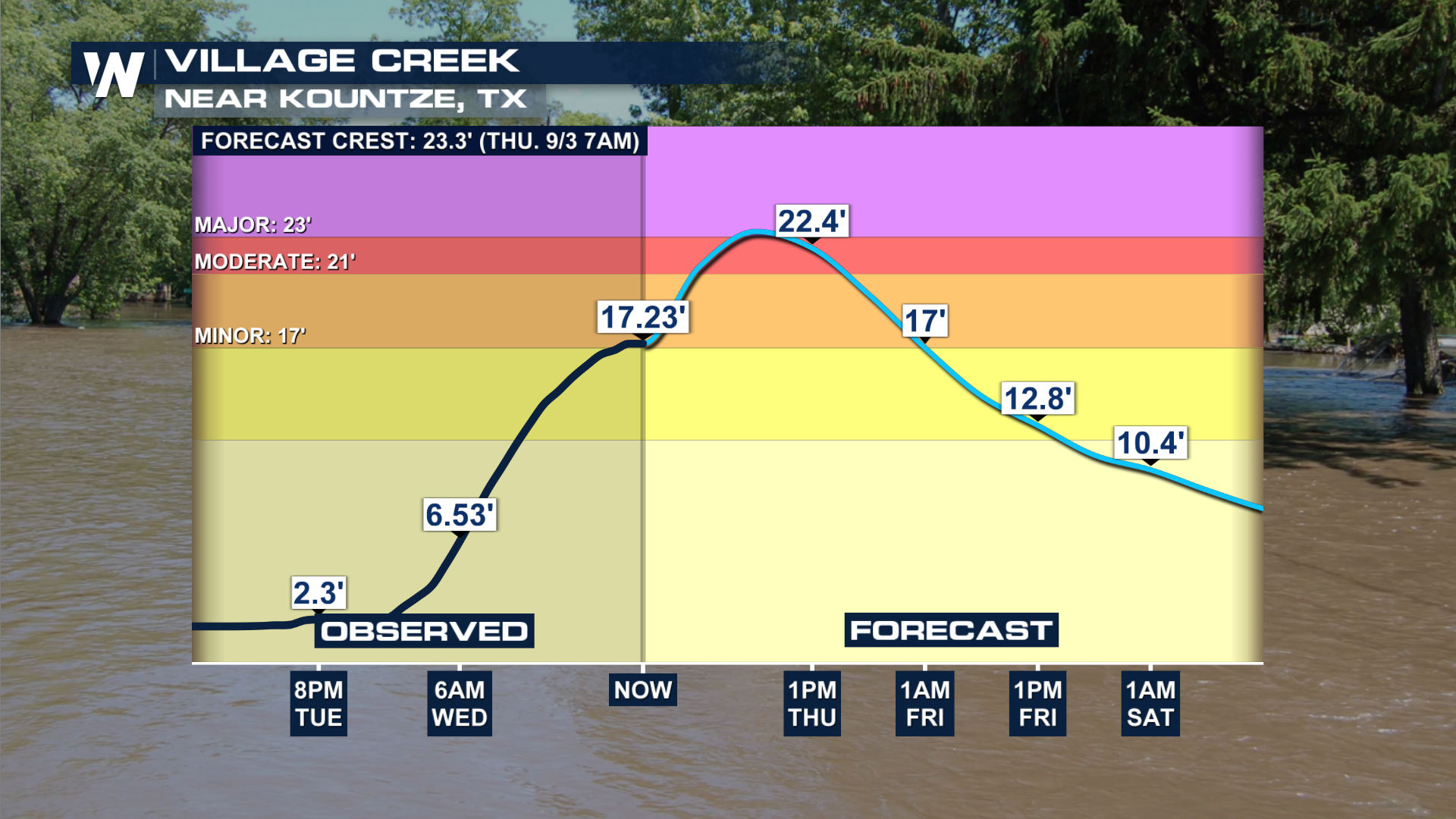
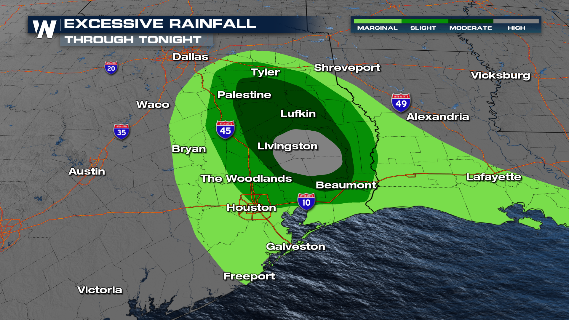 Part of the reason for such a high risk is because of the amount of rainfall that happened in such a short period of time and rivers cresting and exceeding their banks very quickly. The city of Kountze, Texas experienced some significant flooding as Edouard moved inland and we're expecting to see the river crest throughout Thursday.
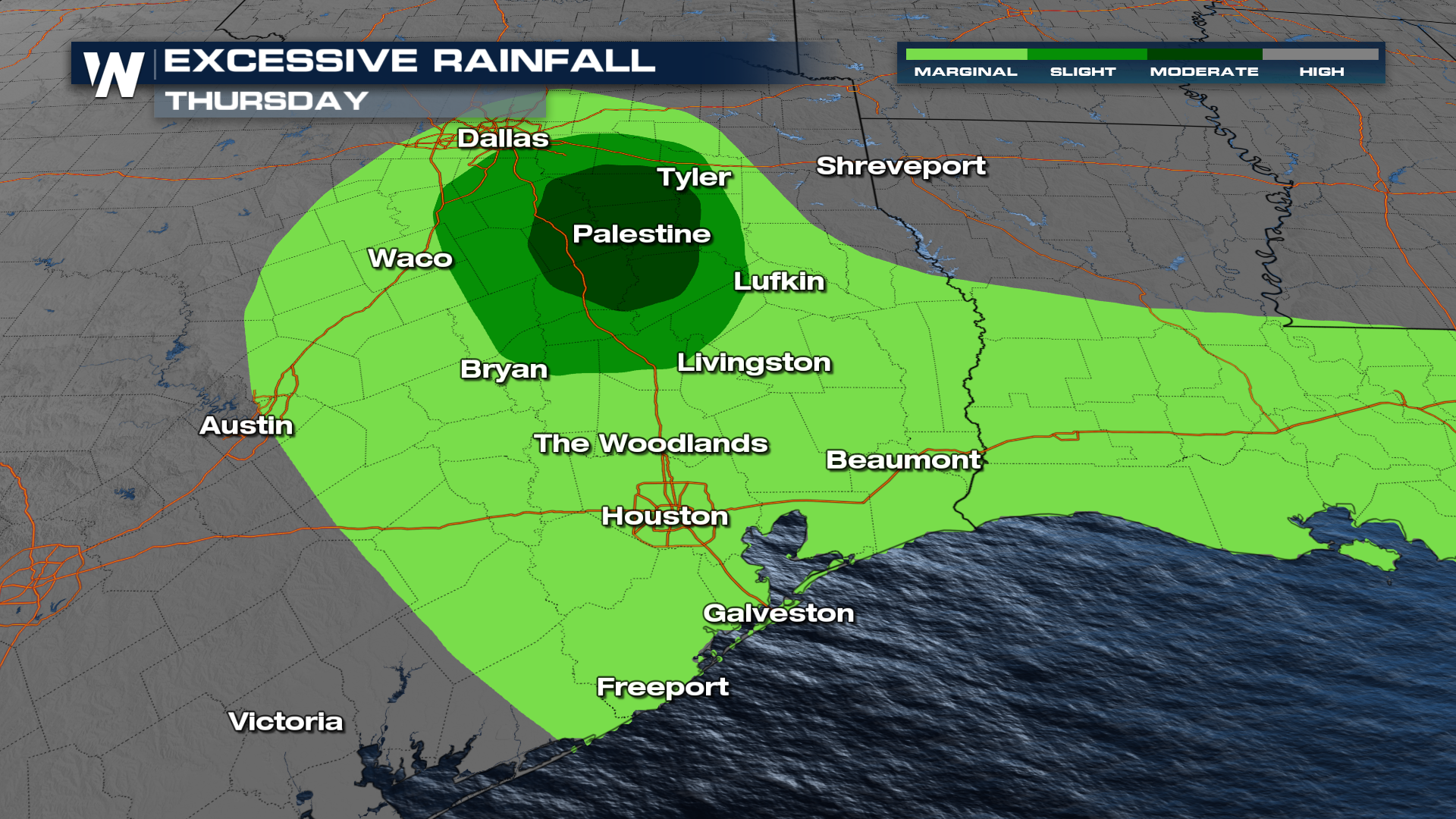
 For Thursday, the WPC increased their flooding potential to a level 3 out of 4, MODERATE, risk for flash flooding.
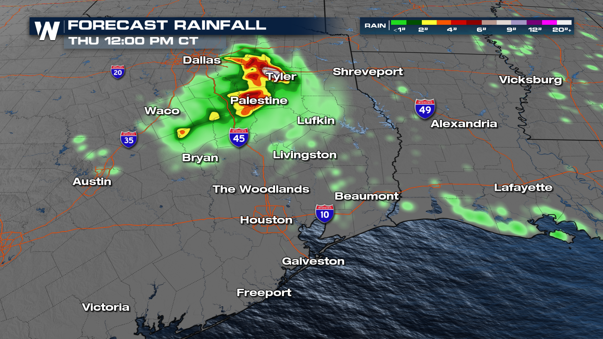
 Rainfall totals may still exceed 5-6 inches in many east and north Texas locations through Thursday.
El Niño has been smothering tropical waves in the Atlantic this summer, with four named storms to date but only 10% of average cyclone energy!
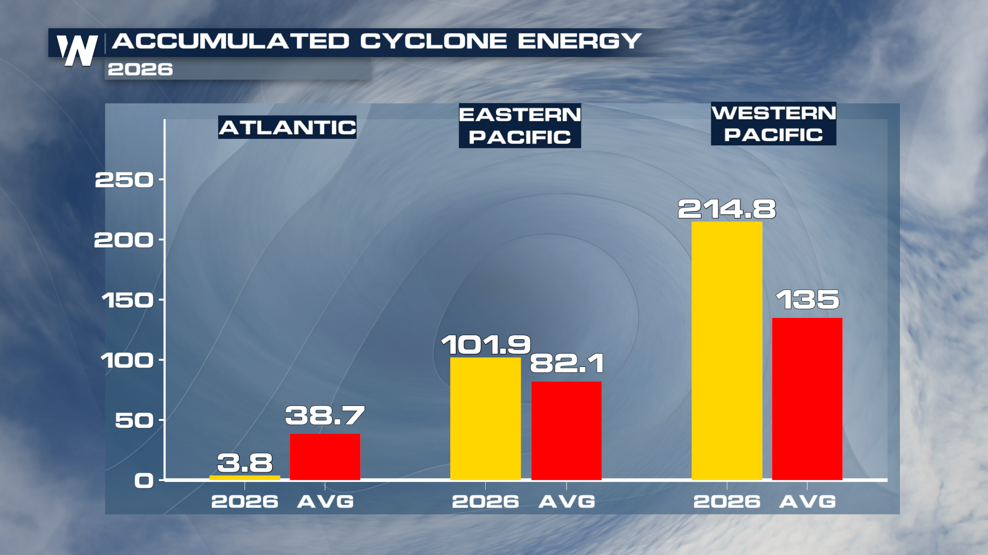 This doesn't mean the rest of the season will be just as quiet, however, as 66% of all hurricane activity in the Atlantic occurs between August 20th and October 10th. The climatological peak of Atlantic Hurricane Season is September 10.