Wednesday Severe Threat in the Northern Plains
A trough is bringing a wave of moisture and energy into parts of the Pacific Northwest and the Northern Rockies over the next few days. As this occluded low-pressure system pushes into the Northern Great Plains by the middle of the workweek, we start to see more storm chances form along the frontal boundary.
Related article: Storm Threat Reaches the Great Lakes
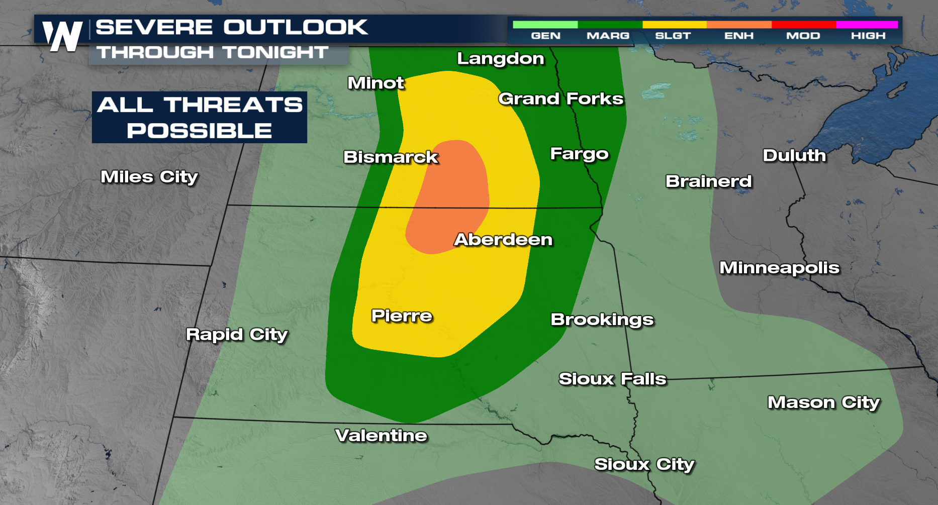
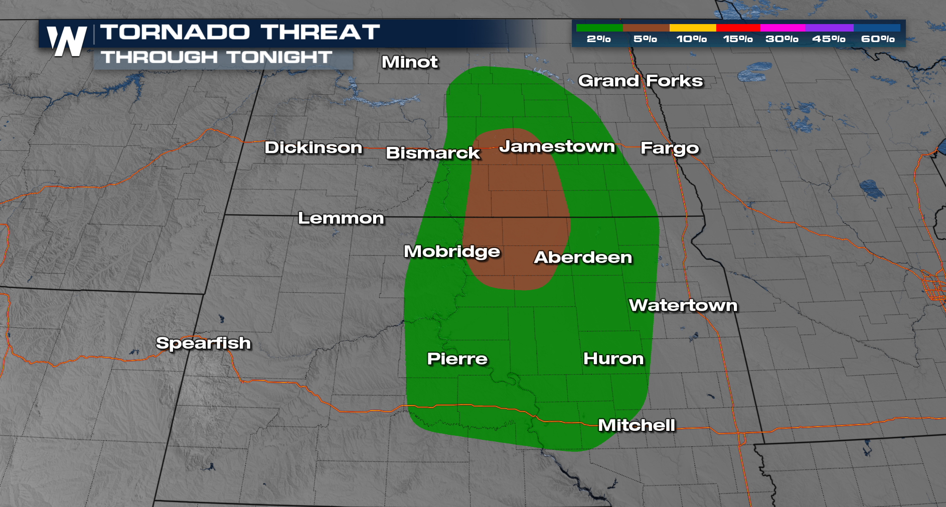
This led to a slight and enhanced risk (up to level 3 out of 5) issued from the Storm Prediction Center in the Dakotas. The main concerns with tonight's storms are strong wind gusts and large hailstones. A few isolated tornadoes will be possible too.

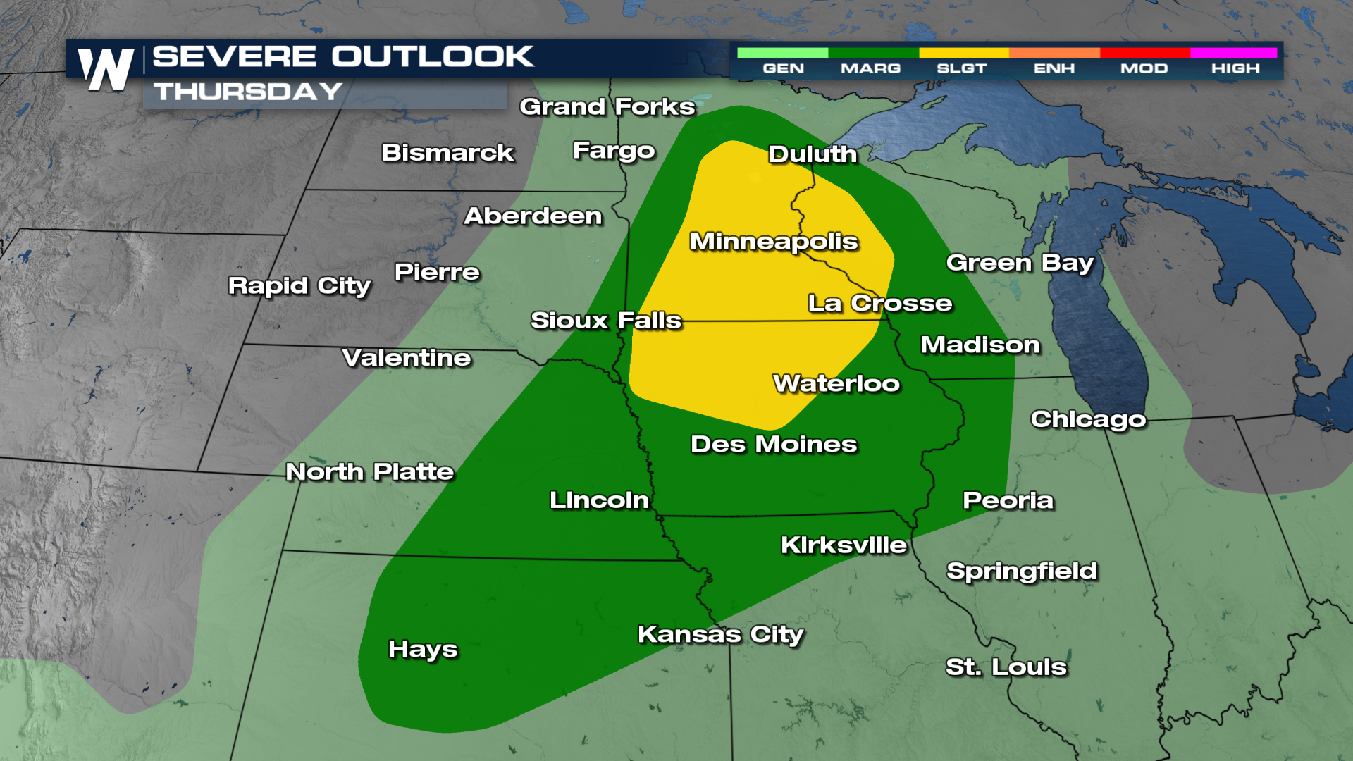
Another marginal to slight risk (level 2 out of 5) is issued in the Midwest on Thursday as some of the instability necessary for strong storms slowly moves east. It reaches from northern Minnesota, into Iowa, Nebraska, and through northern Kansas. As this is a multi-day severe threat, make sure severe weather fatigue doesn't get the best of you. Have multiple ways to get weather alerts and stay weather aware moving forward.

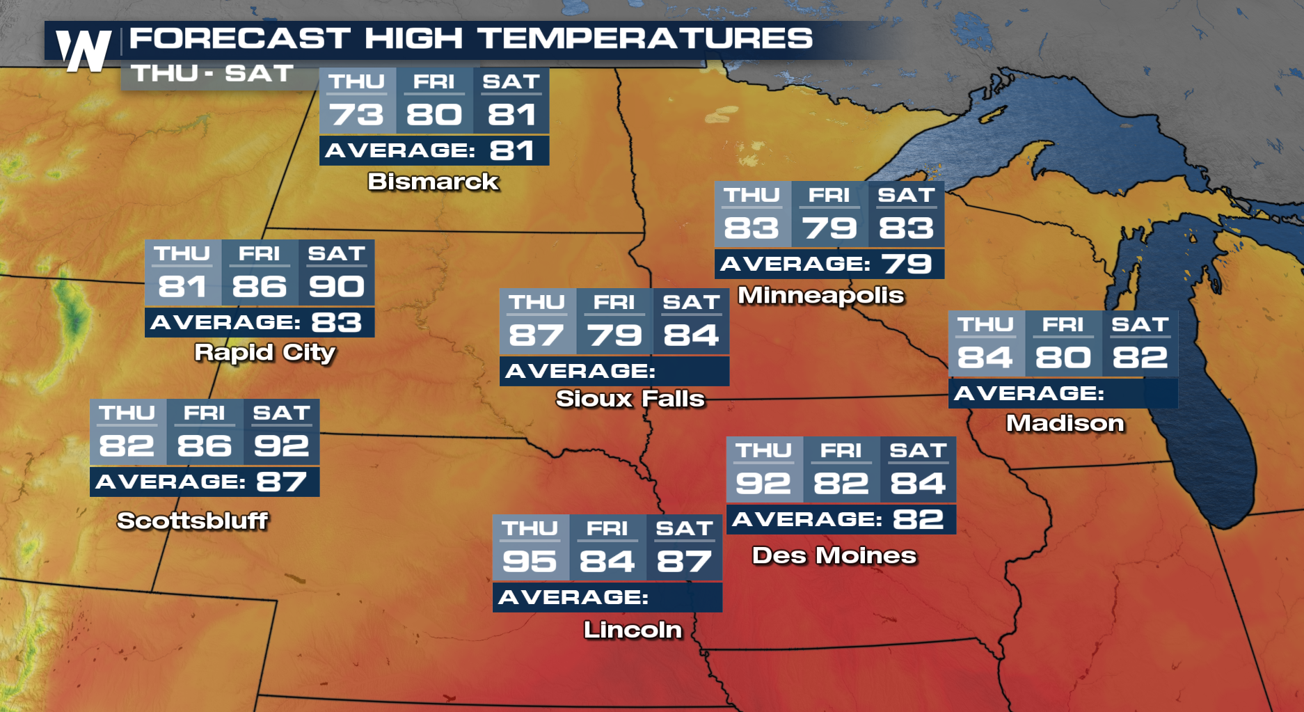
Thanks to this system, and the strange set-up we have, temperatures will be jumping all over the place over the next three days. Be prepared for a little bit of weather whiplash as high temperatures can swing between a 10-15° difference with each afternoon. Stay with WeatherNation for more on this forecast.