Hot Temps & High Fire Danger in Texas, Plains
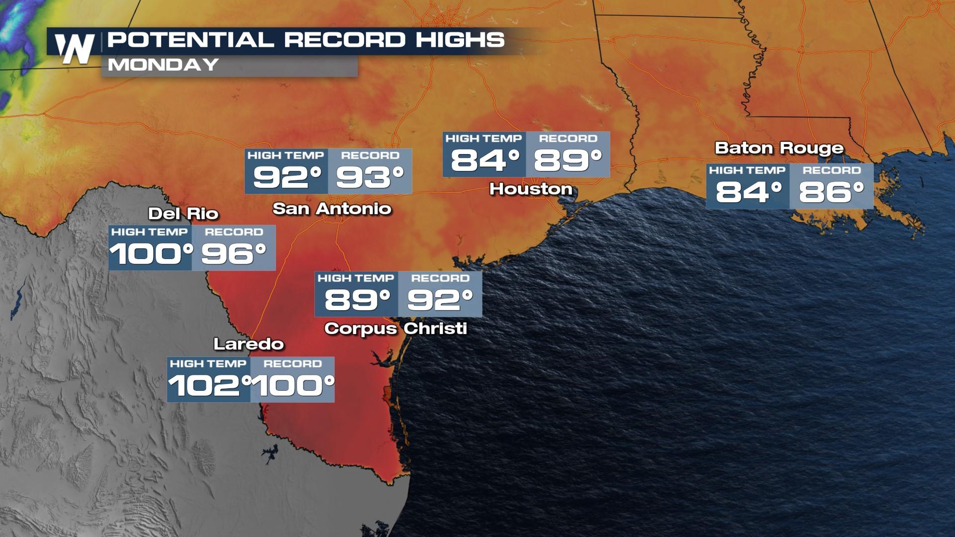
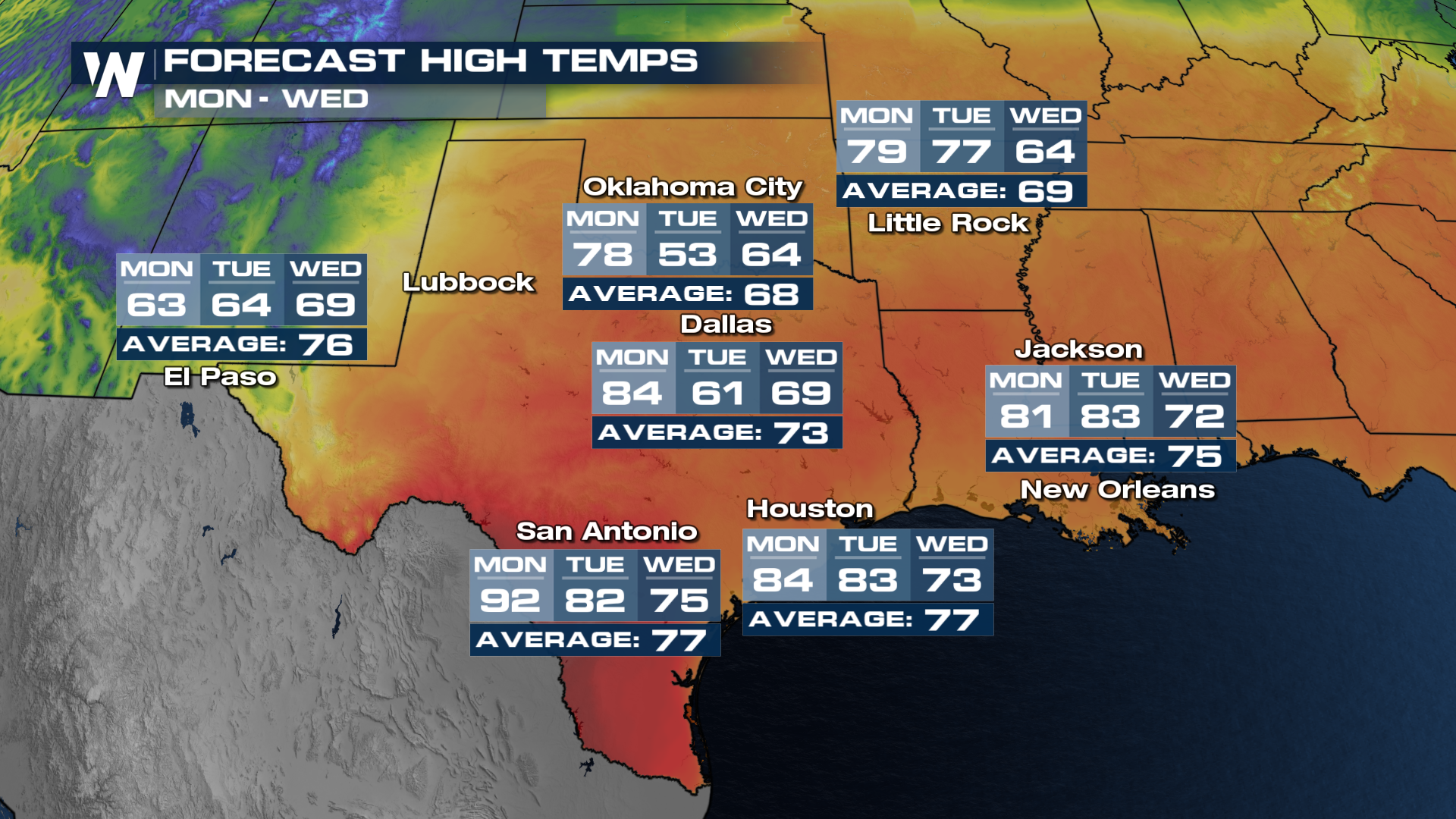
Get ready for a roller coaster ride of temperatures and weather this week in the southern Plains. A ridge of high pressure has settled over the southern U.S. and Gulf Coast, bringing mild temperatures north at the start of a new month. We could see some of our first 100° days of the year in south Texas. As is typical in early Spring, the warm weather doesn't last too long as a trough of low pressure arrives, cooling temps down.
Related Article - Severe Weather Threat in the U.S.
Temps will be at their warmest Monday before colder air arrives with a rain chance. Monday will feature widespread 70s and 80s with some cities in far south Texas jumping even warmer. Look how temperatures plummet from Monday into Tuesday, especially in central Texas.
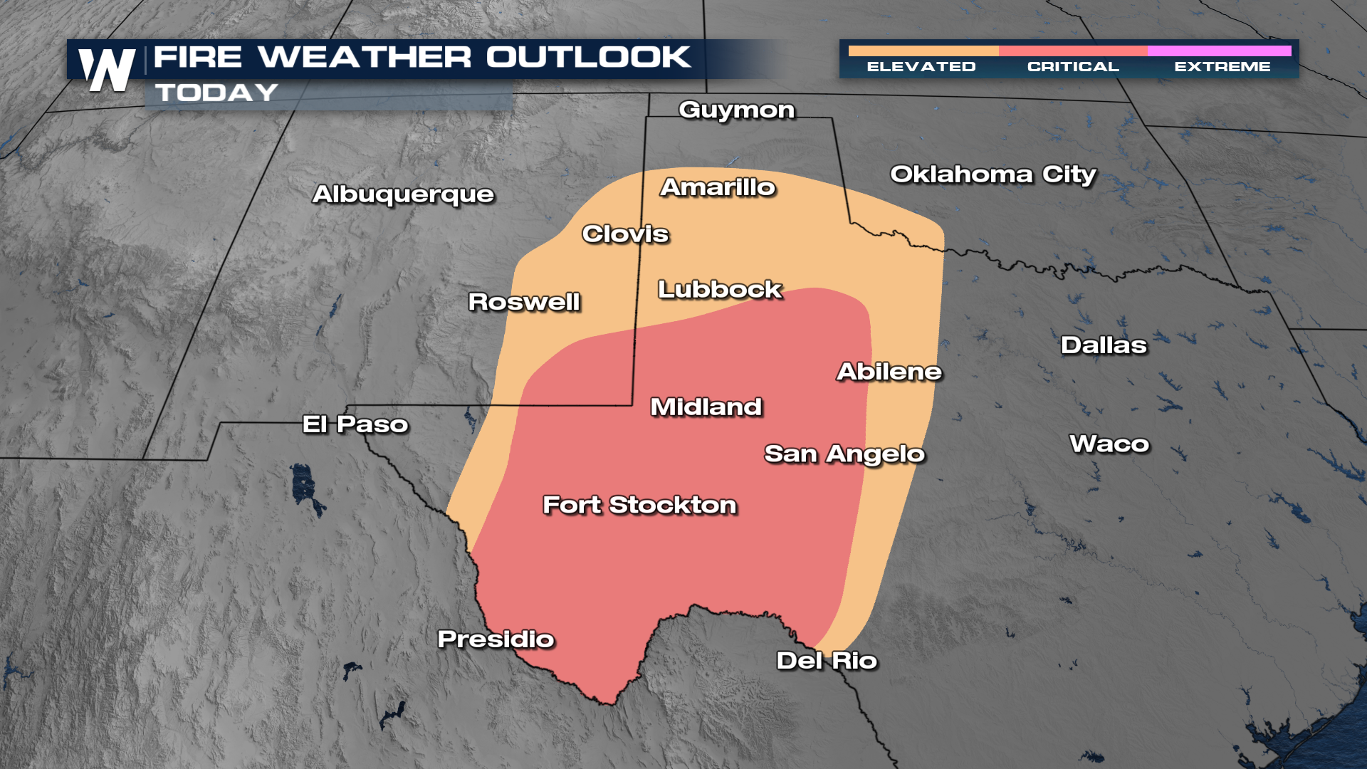
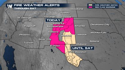
 Alongside these warm temperatures, there is a critical risk of wildfire danger throughout the day on Monday. Red Flag Warnings are in effect for West Texas and Southeast New Mexico along with wind alerts for gusts upwards of 60 mph at times. This will fan any flame that gets started today. Please prevent any outdoor burning and don't toss cigarette butts. Check your car for dragging chains as those can also start fires.