Strong Weekend Storm System for the Northwest

Top Stories
15 Feb 2018 4:47 AM
We have some active weather in the forecast for the upcoming weekend in the Northwest. A strong area of low pressure will be moving south out of the Gulf of Alaska by Friday and bring with it rain, snow and very strong winds.
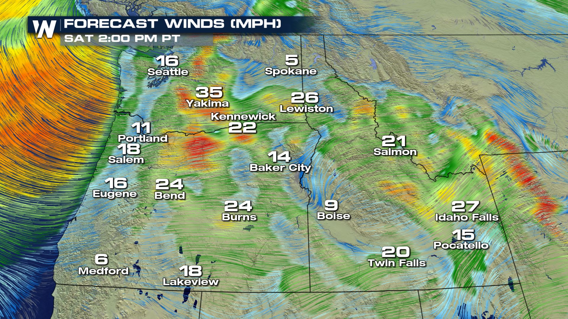
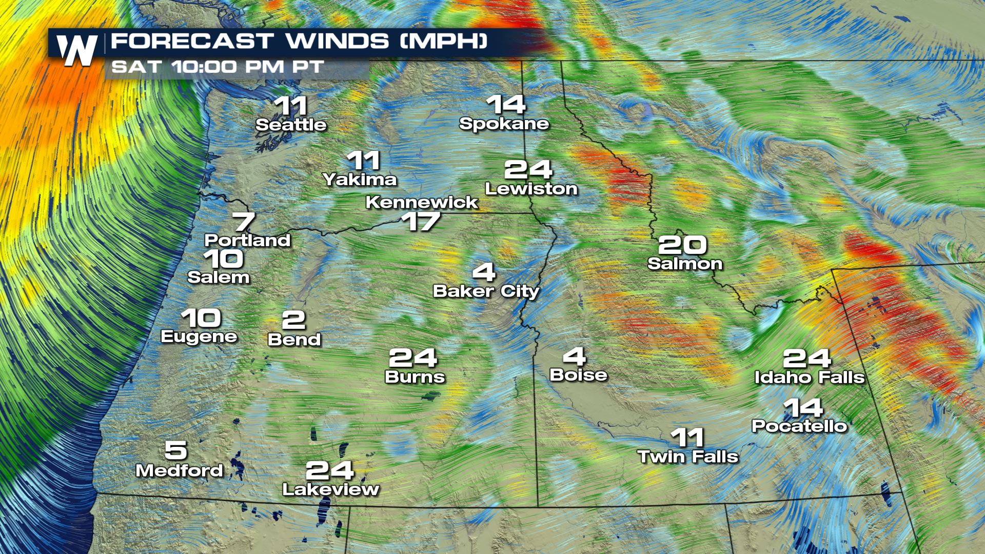
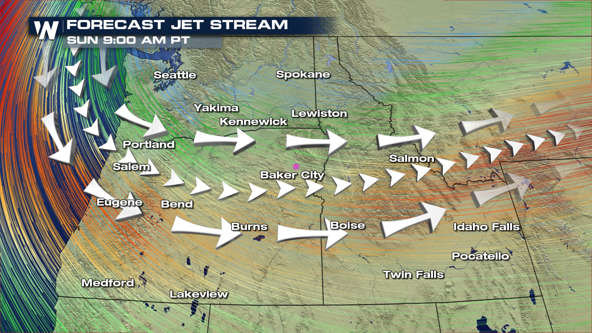 You can see the strong upper-level winds by early Sunday morning, especially over Oregon and Idaho. These strong upper winds will also influence the surface with strong winds as well.
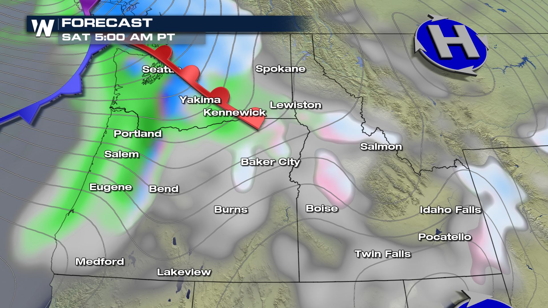
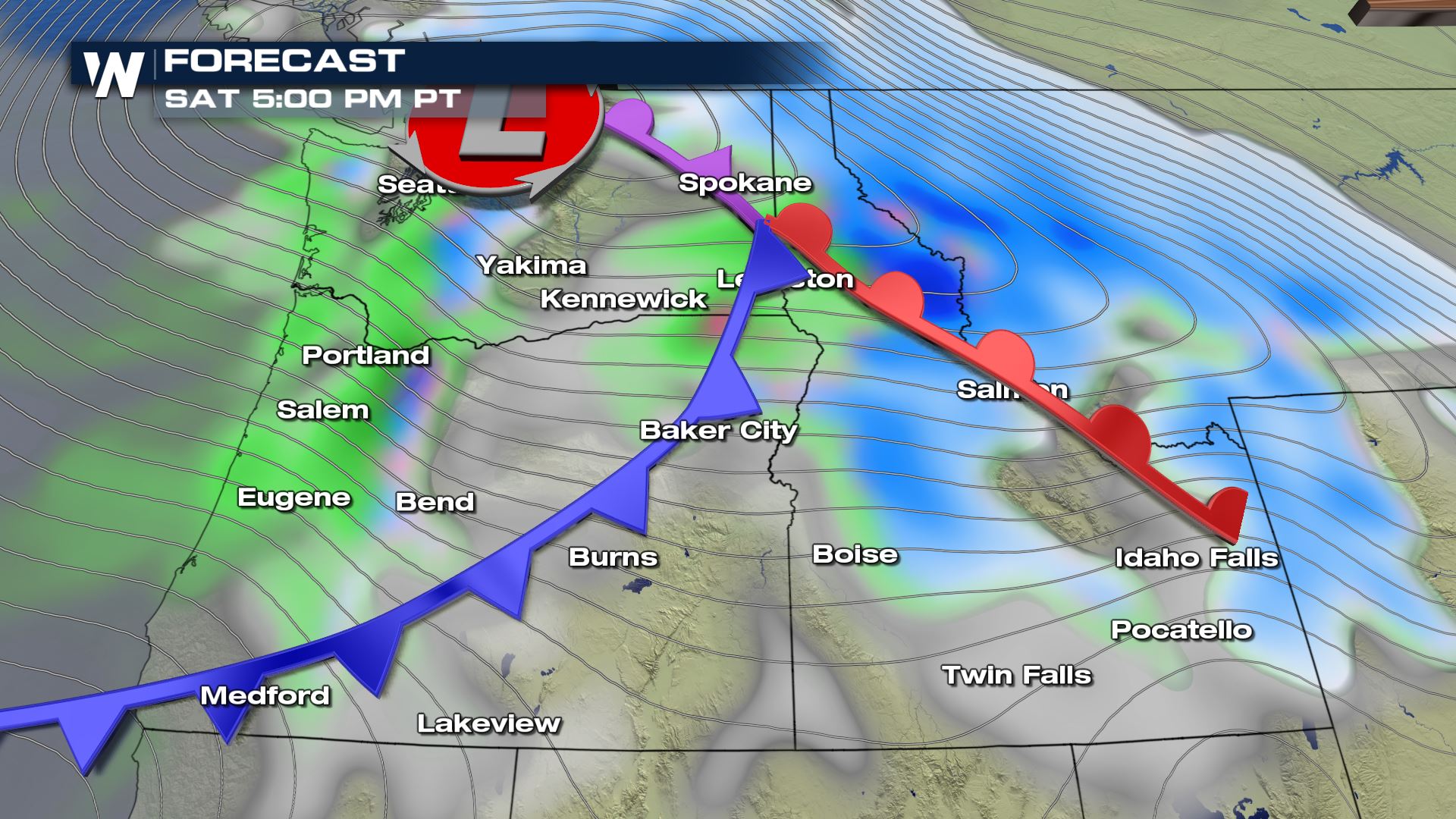 At the surface a low pressure system will push onshore by early Saturday morning. Rain and mountain snow will be likely for parts of Washing, Oregon, Idaho and Montana. Also...notice the lines on the map...those are called isobars and they represent the measurement of pressure. So when you see those lines packed closely together, it's called a tight pressure gradient and that means very strong winds.
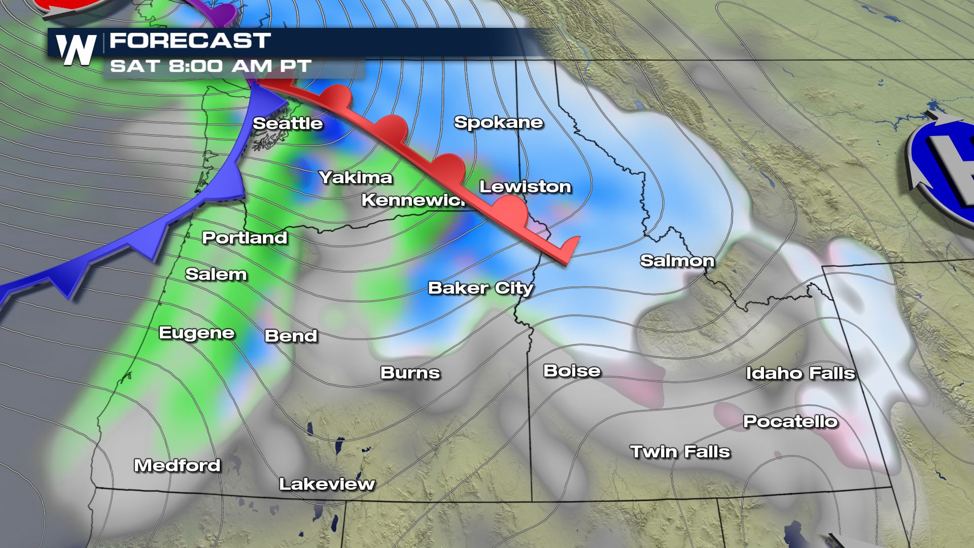
 At times wind speeds will range from 30-40 mph and wind gusts could be approaching 50 mph. These strong winds will also lead to small craft advisories and high waves along the coast.
 Meteorologist Patrick Crawford
Forecast
You can see the strong upper-level winds by early Sunday morning, especially over Oregon and Idaho. These strong upper winds will also influence the surface with strong winds as well.
At the surface a low pressure system will push onshore by early Saturday morning. Rain and mountain snow will be likely for parts of Washing, Oregon, Idaho and Montana. Also...notice the lines on the map...those are called isobars and they represent the measurement of pressure. So when you see those lines packed closely together, it's called a tight pressure gradient and that means very strong winds.
Wind Forecast
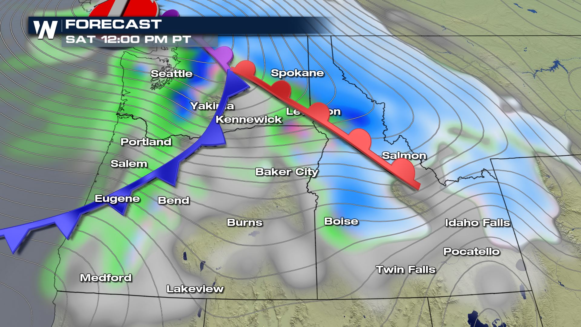
Take a look at some of the winds that are in the forecast for Saturday.
At times wind speeds will range from 30-40 mph and wind gusts could be approaching 50 mph. These strong winds will also lead to small craft advisories and high waves along the coast.
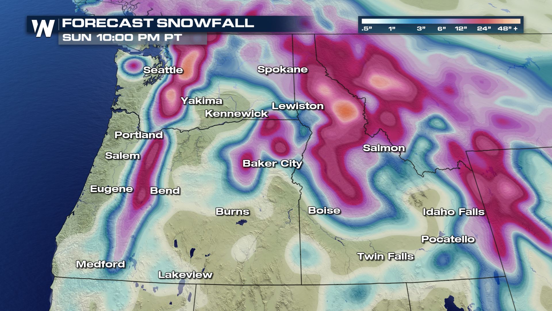
Snowfall
This system will also bring some heavy snow to the mountains. Take a look at the latest snowfall accumulation map.
Meteorologist Patrick CrawfordAll Weather News
More
CSU, First 2025 Hurricane Season Forecast Above Average
Today, meteorologists and research scientists
13 Apr 2025 9:05 AM

Spring Heat Wave Incoming: Record Highs Likely Across the Western U.S.
A surge of unseasonable heat is about to swee
13 Apr 2025 2:20 AM

Active Weather Next Week Including Snow and Severe Thunderstorms
While much of the Southwest has been baking u
13 Apr 2025 2:00 AM

Fire Threat Continues Into Sunday Across the West
As an upper level high pressure sits and spin
13 Apr 2025 1:40 AM

Wintry Precipitation Chances Return to the Northern States Sunday
A strengthening storm system from the Northwe
13 Apr 2025 1:30 AM

Rain and Snow Continue for the Northeast
Back-to-back low pressure systems have kept t
12 Apr 2025 8:30 PM

MASTERS FORECAST: Great Weather Into the Weekend!
It's that time of year again! Spring is offic
12 Apr 2025 10:10 AM