Severe Storms Saturday For The Plains
Severe storms formed late Friday in New Mexico and Texas, some of which continued Saturday producing frequent lightning, heavy rain, and big hail stones.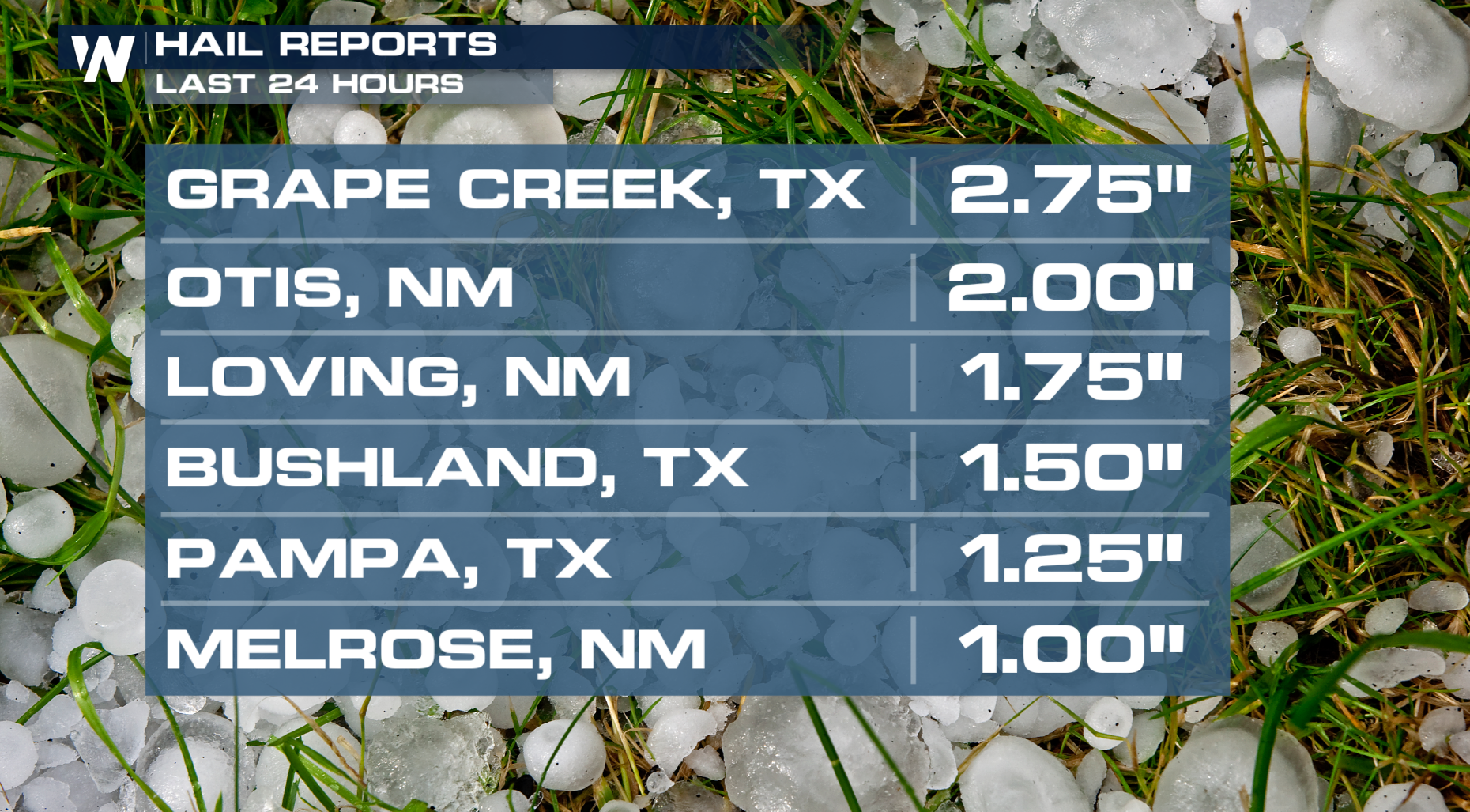
Most of Saturday's action of severe thunderstorms were confined to the New Mexico Texas border. As we move into the overnight hours, we should see the severe weather threat slide northward into Oklahoma!
Storm Outlooks
A level 2 threat (scattered severe storms) has been issued for Saturday for portions of West Texas, New Mexico, and Oklahoma's Red River Valley where wind and hail damage are likely.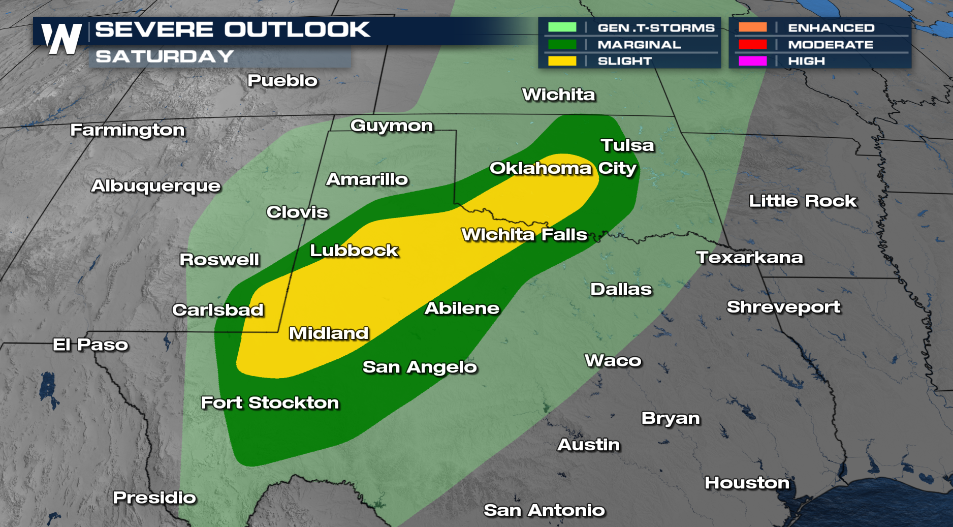
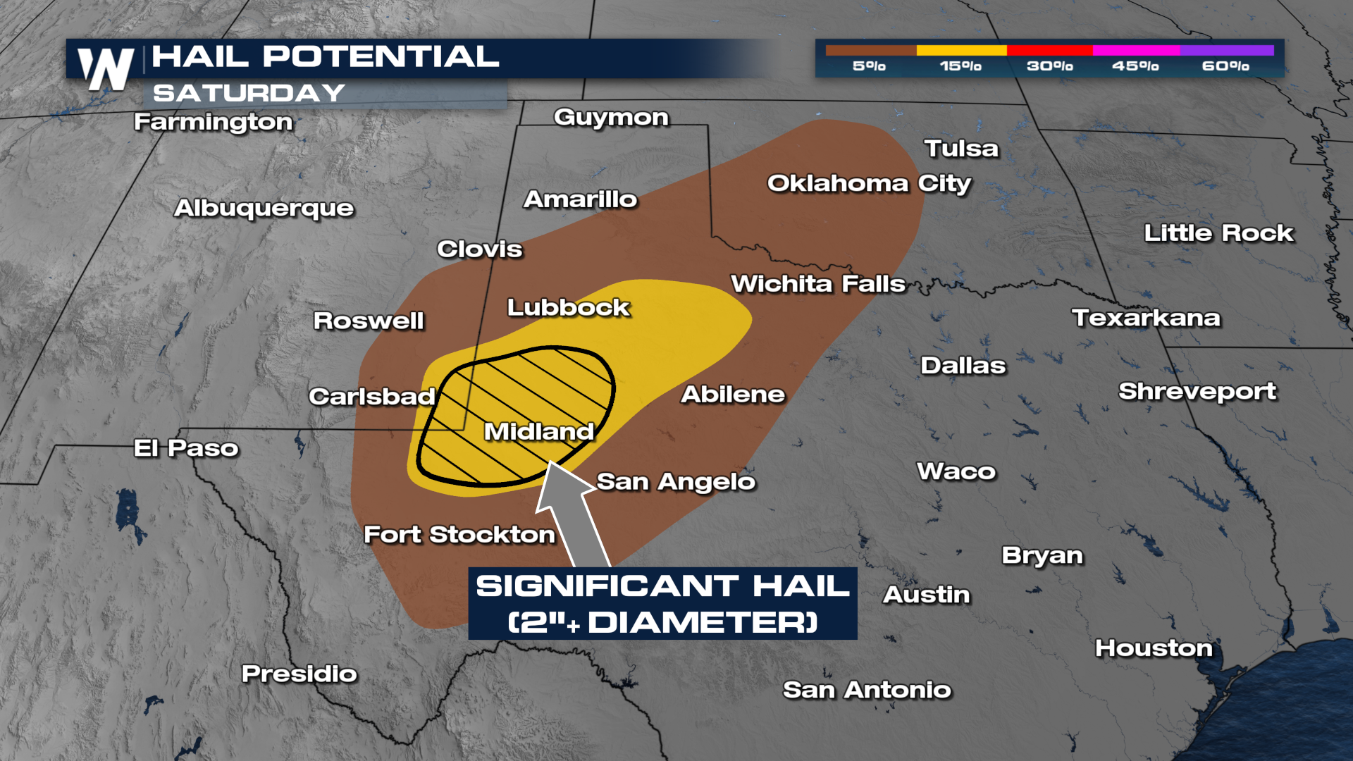
Hail could be significant, with hail stones surpassing the size of golf balls in some areas.
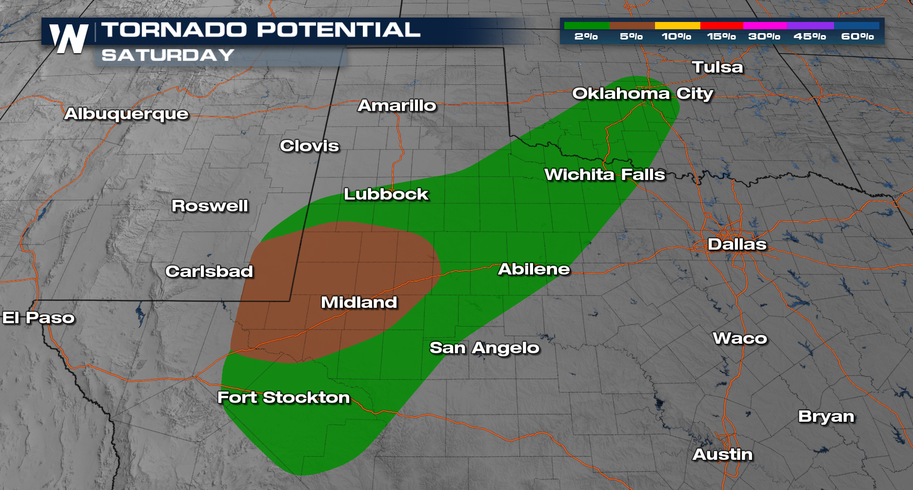
 The tornado threat will be elevated on Saturday too, with the highest chance for a tornado or two around Midland, TX.
Rainfall is expected to cause significant impacts where multiple rounds of storms occur. Pockets of 2-6" of rain are expected, with scattered flash flooding possible.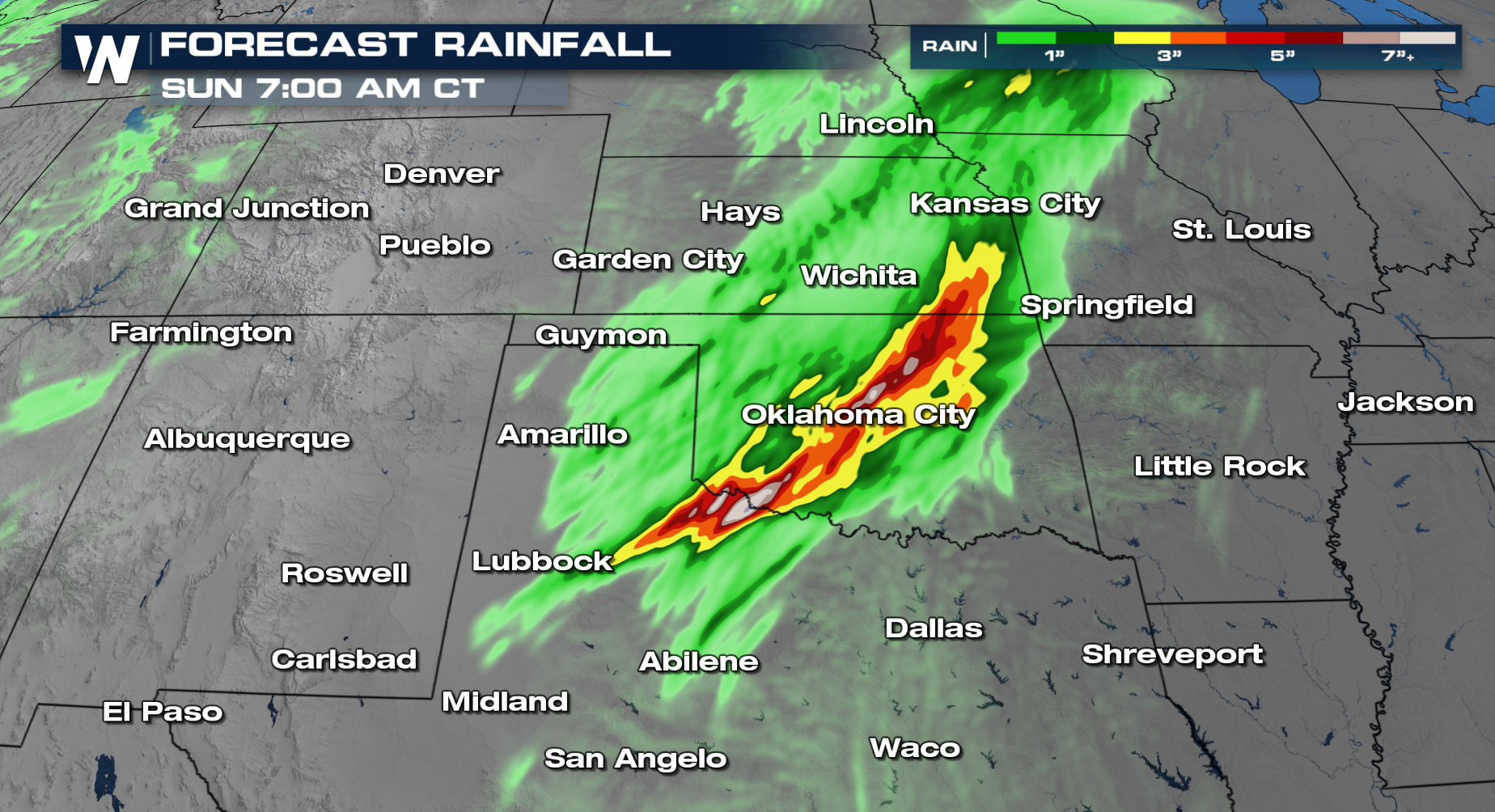
Tune in at :30 past the hour for the latest Central Regional Forecast, or get it on demand with the WeatherNation app.