Triple Digit Temps Take Over the Northwest

Temperatures have been in the 90s along I-5 and 100s inland since the weekend with the hottest day as of late last Wednesday. The ridge of high pressure keeping the Southwest toasty will also keep temperatures toasty into the weekend for the northern Rockies. Temperatures fall slightly in the Pacific Northwest on Thursday thanks to an upper-level area of low pressure, bringing some "relief" as temperatures remain 5-10 degrees above average. Inland areas aren't so fortunate and stay warm through the weekend. The best opportunity to see the relief will be west of the Cascades along I-5.
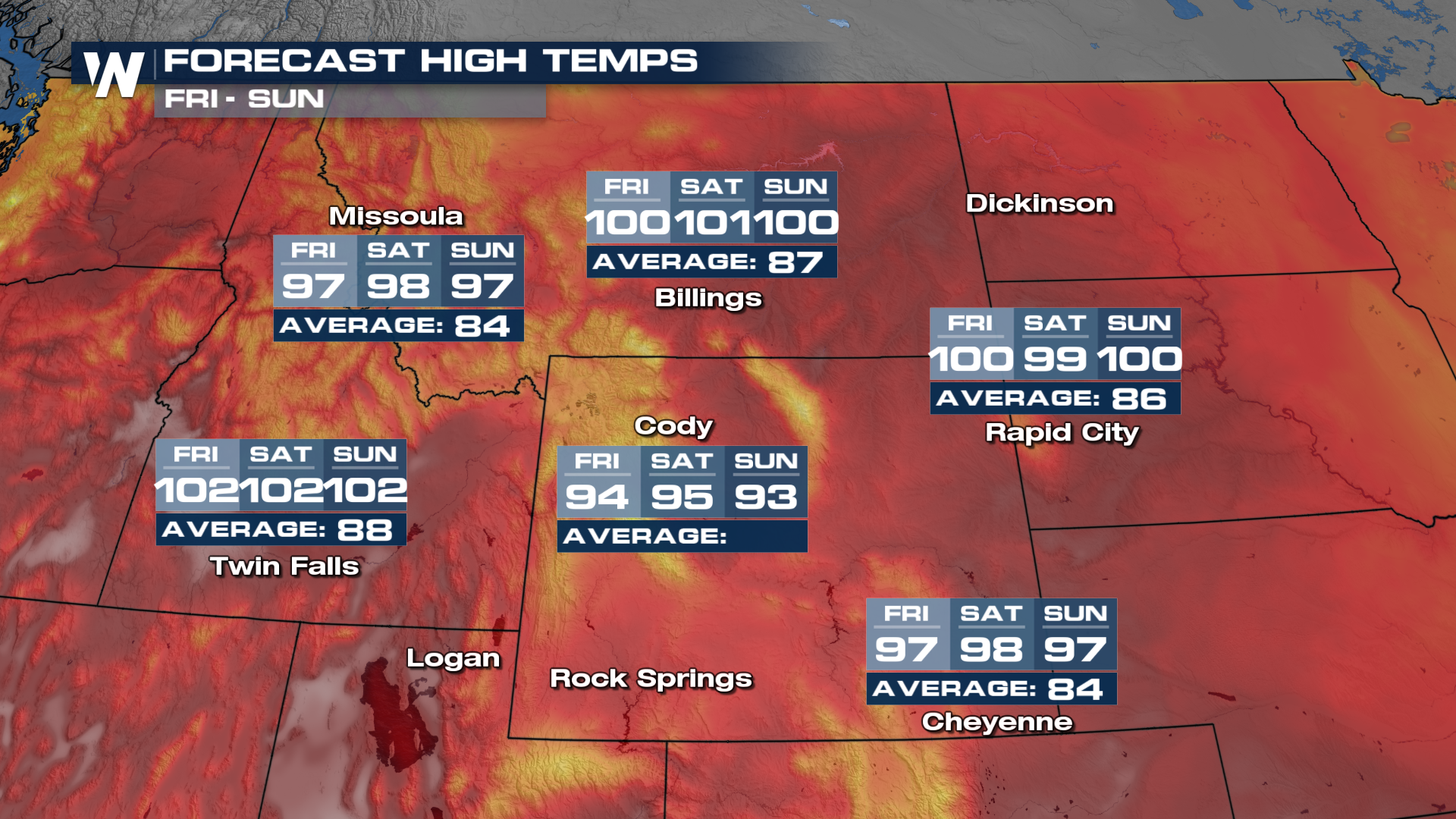
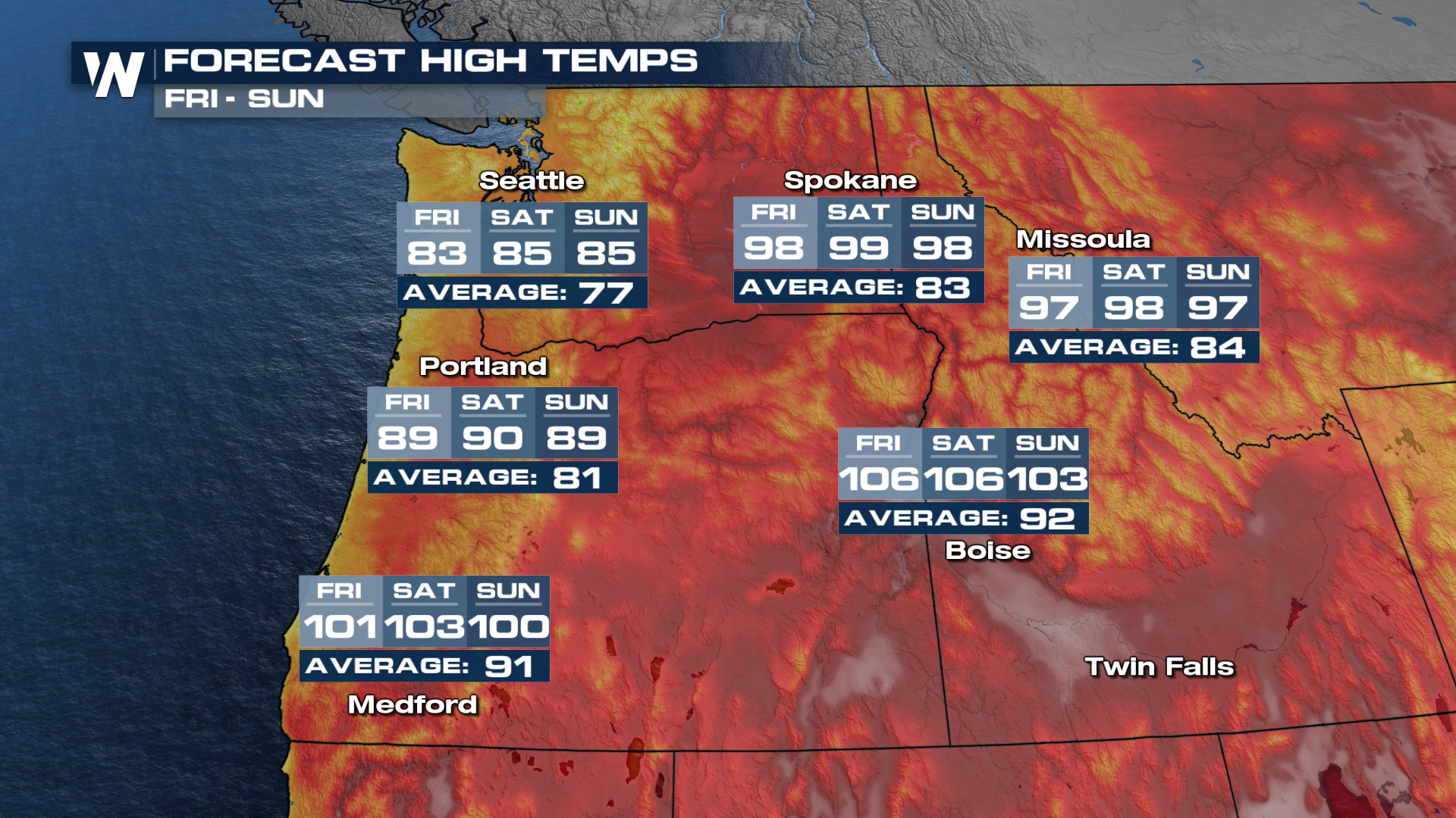 Meanwhile, temperatures over the northern Rockies stay warm through the end of this week and into the weekend as the ridge of high pressure sits over the region. Highs will run 10-15 degrees above average here with the hottest conditions in mountain valleys where air will sink and warm.
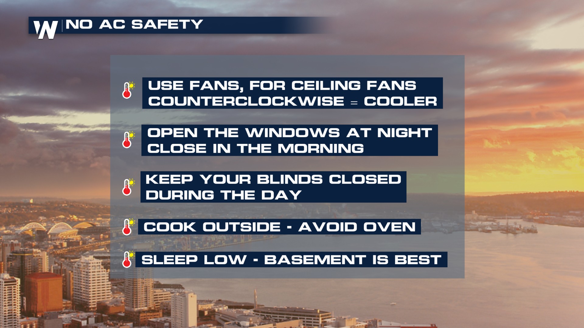
 If you live without A/C this week will be dangerous for you - please make sure you plan accordingly by preparing your home and seeking out cool spaces. Malls, movie theaters, and community cooling centers are the best places to stay.