October Outlook: Hot and Dry Conditions To Continue for Many

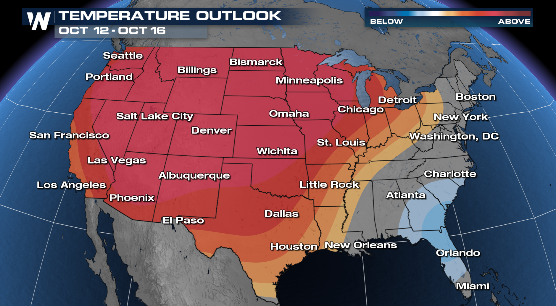
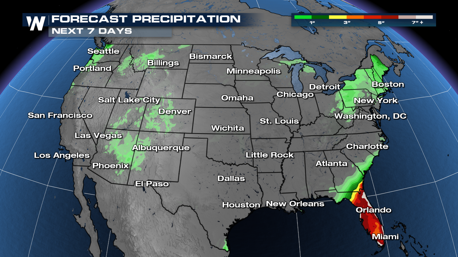
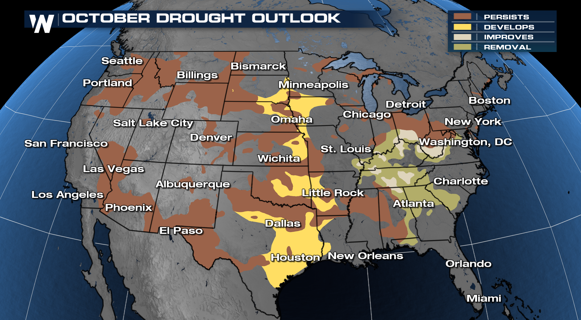
The Climate Prediction Center's October Outlook is out and hot and dry conditions may continue for awhile. The stretch of above average temperatures is likely to continue for much of the Western United States! On the flip side, confidence is growing in more below average precipitation especially in areas of the Plains and the Four Corners. The downside of this current pattern continuing will be building drought, some agricultural impacts as we approach harvest time, and the fire threat. As a result, drought is looking likely to expand in parts of Texas into the Central Plains this month!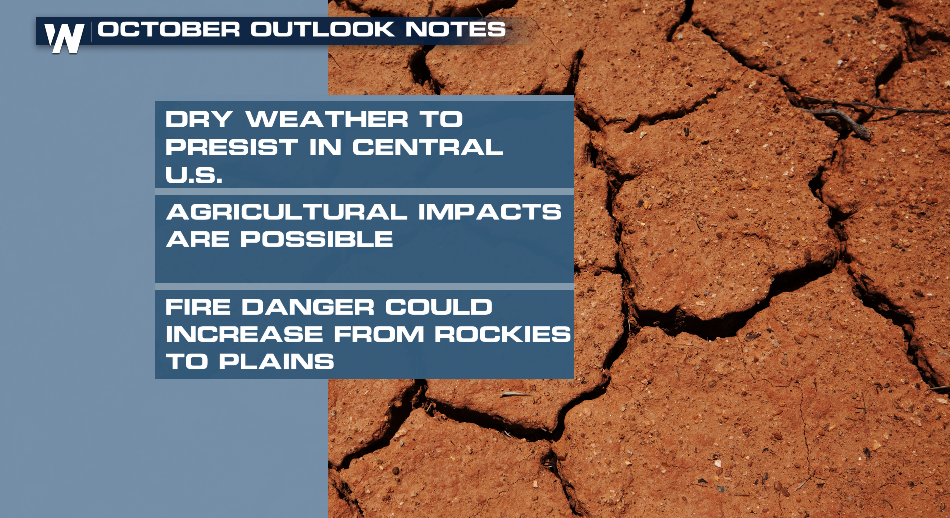
THE WEATHER PATTERN
Another thing we can look at to better explain the current weather pattern is looking at La Nina and ENSO neutral pattern. As you may know, we have transitioned out of El Nino and now soon will be going into La Nina conditions. Before we move into a full La Nina pattern, the United States is in an ENSO Neutral pattern and the picture below does a great job of explaining what we have dealt with recently. It is very warm in the Southern Plains and Southwest while the northern tier is seeing some cooler air from time to time.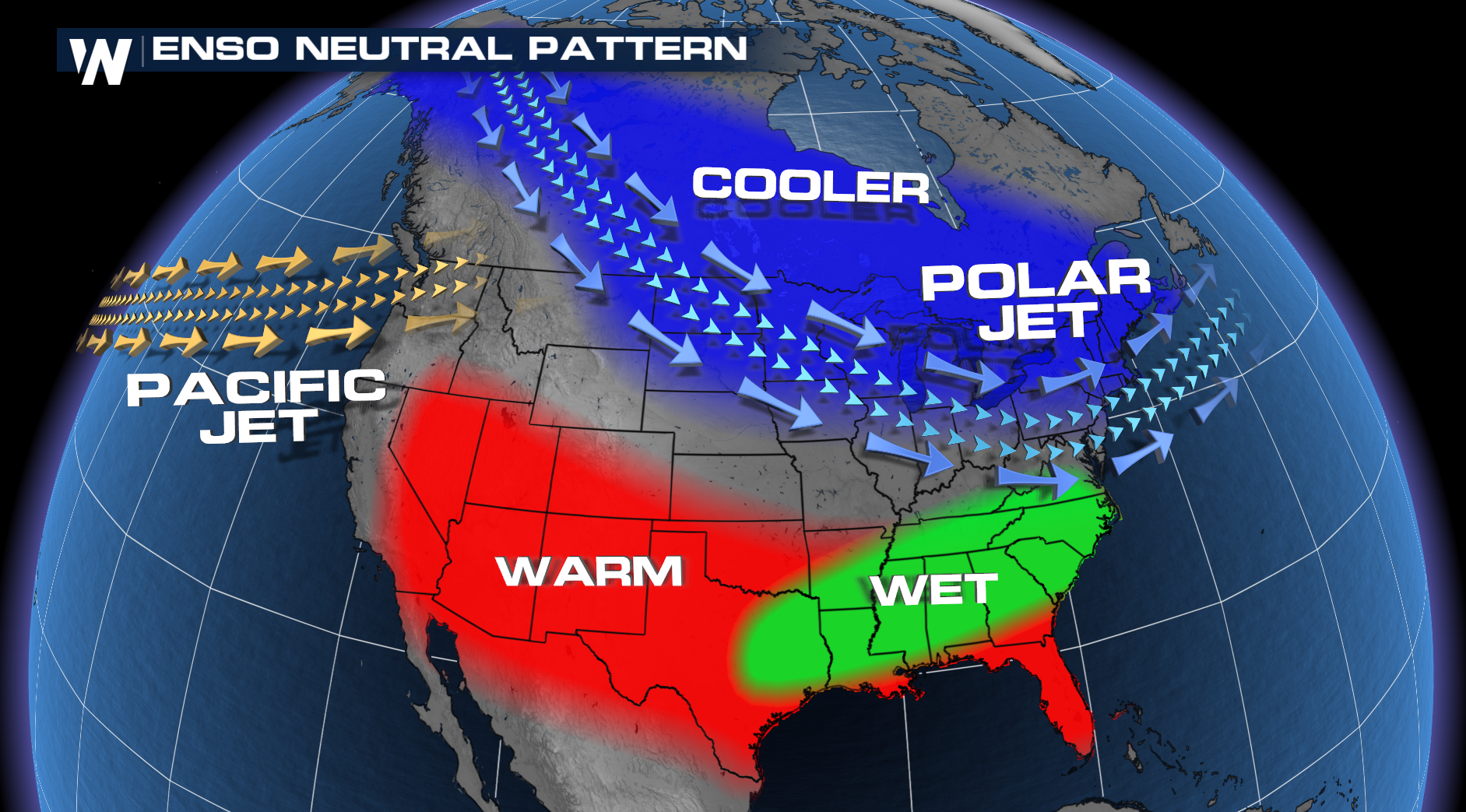 Also of note, the jet stream is very active along the United States and Canadian border. This is why the pattern has been very busy from the Pacific NW to the Northeast and everyone else it has just been super quiet outside of the tropical activity in the South.
NEXT SEVEN DAYS
As we move forward into the month of October, if you are looking for the consistent fall air feel you might want to head to the East Coast. Confidence is increasing in cooler than normal temperatures for the Northeast and Southeast. On the rainfall side, it stays very dry for many folks. As mentioned above, this current pattern is concerning because of fire danger increasing and impacts to the agricultural sector!