NOAA GOES-S Satellite, Now GOES-17
Special Stories
13 Mar 2018 8:25 AM
Monday was a big day for the GOES-S satellite. It has reached geostationary orbit (22,300 miles out in space) and has now officially received a new name...GOES-17! The satellite will be called GOES-17 for the remainder of its lifespan. GOES satellites are designated with a letter prior to launch and a number once they achieve geostationary orbit.
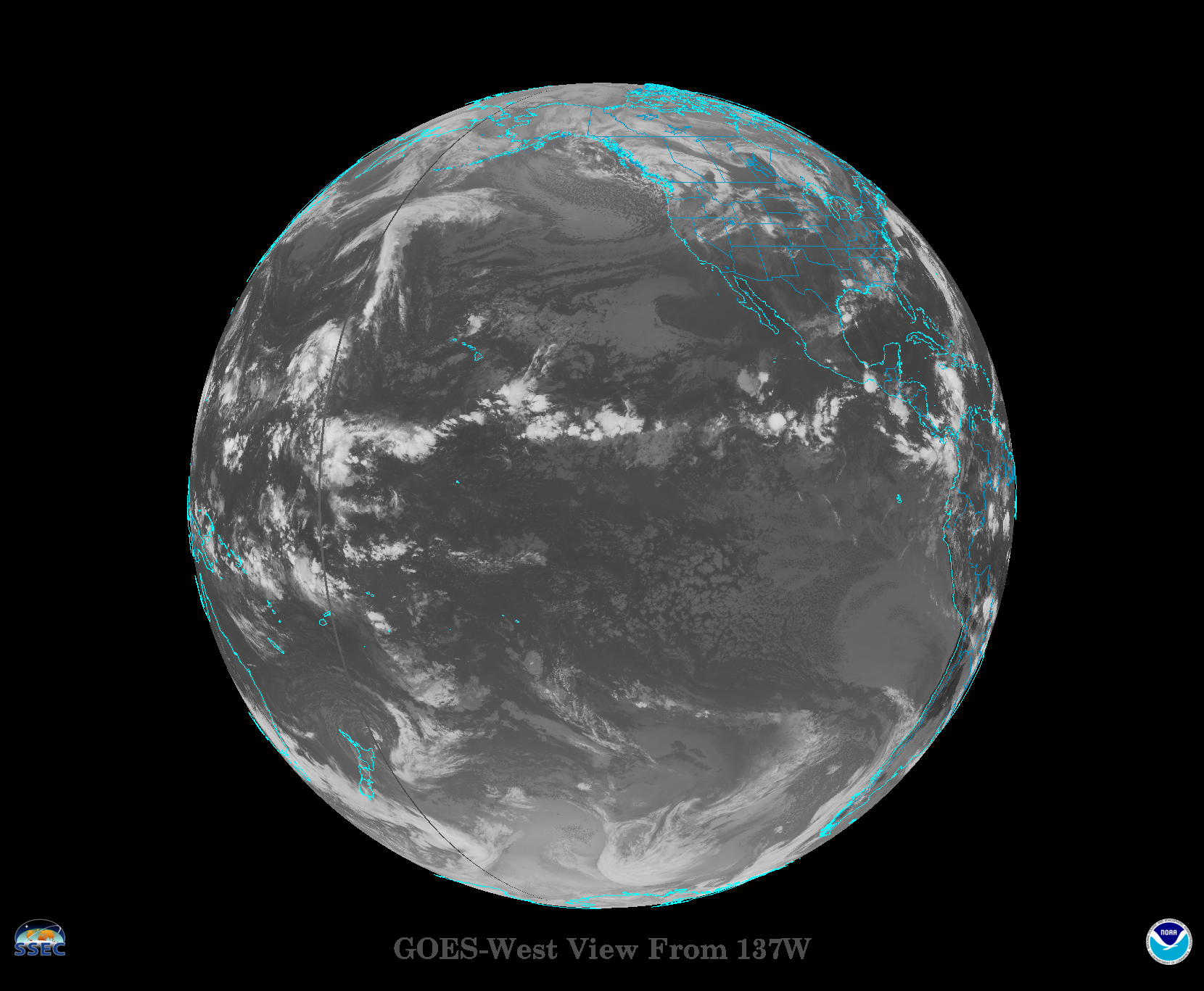
 [The image shows the GOES West operational location coverage map.]
The satellite was launched on March 1st. Later this year, after undergoing a full checkout and validation of its six high-tech instruments, the new satellite will move to the GOES-West position and become operational. From there, it constantly will provide advanced imagery and atmospheric measurements, real-time mapping of lightning activity, and improved monitoring of solar activity and space weather.
https://www.facebook.com/WeatherNation/videos/10156296250339874/
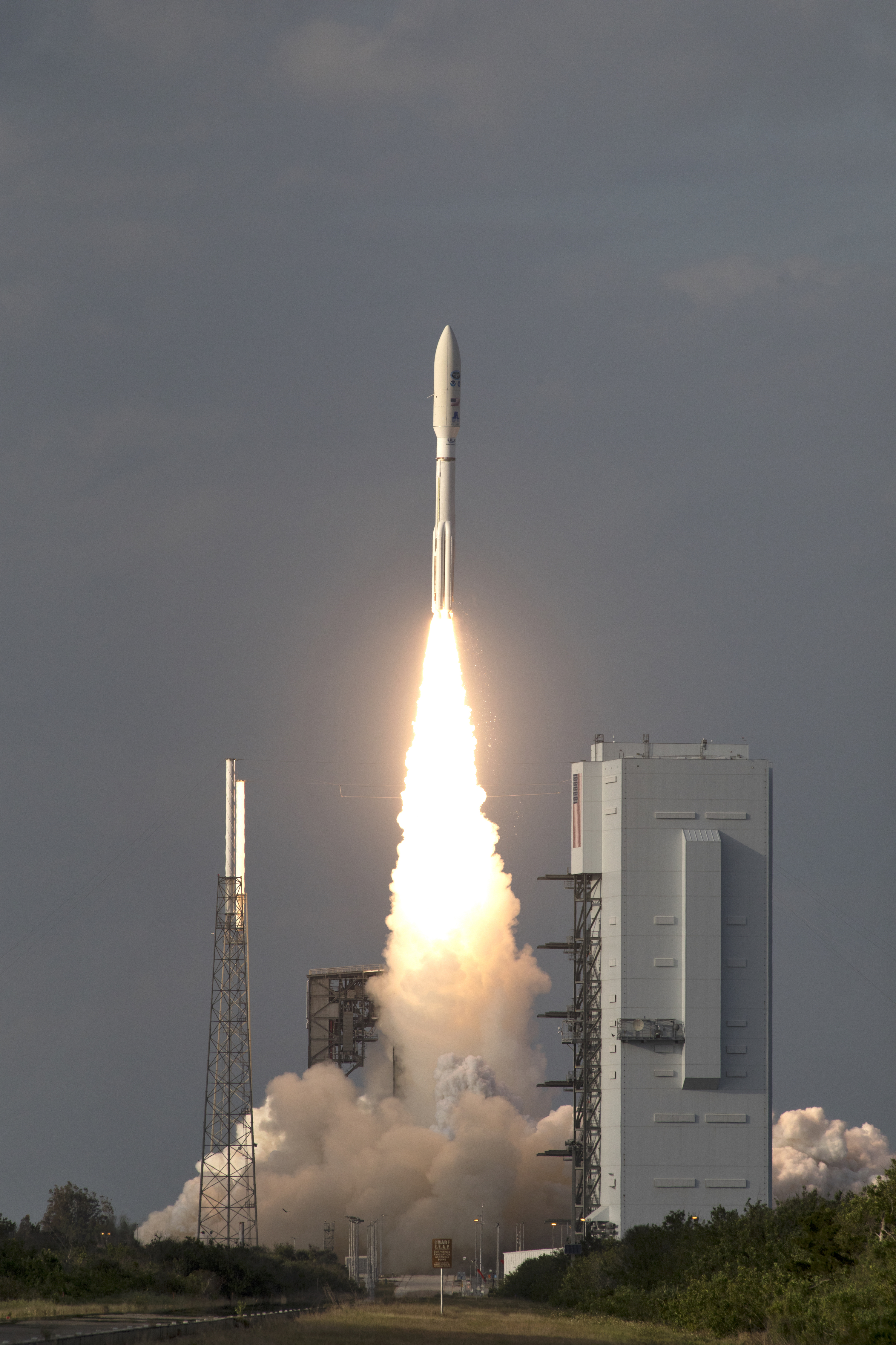
 [A United Launch Alliance Atlas V rocket lifts off from Space Launch Complex 41 at Cape Canaveral Air Force Station carrying GOES-S. at 5:02 p.m. on March 1st]GOES-17 will provide coverage of the Western US, Alaska, Hawaii, the Pacific Ocean, Mexico, and Central America,” said Ajay Mehta, acting deputy assistant administrator for systems at NOAA’s National Environmental Satellite, Data and Information Service (NESDIS). GOES-17 will be working with GOES-East to continue to send back images and data that will assist meteorologists with forecasts and aid in decision making by community and national leaders.
https://twitter.com/WeatherNation/status/966694210089955329
The GOES-S satellite will provide faster, more accurate and more detailed data, in near real-time, to track storm systems, lightning, wildfires, coastal fog and other hazards that affect the western United States.
For WeatherNation: Meteorologist Mace Michaels
 [The image shows the GOES West operational location coverage map.]
The satellite was launched on March 1st. Later this year, after undergoing a full checkout and validation of its six high-tech instruments, the new satellite will move to the GOES-West position and become operational. From there, it constantly will provide advanced imagery and atmospheric measurements, real-time mapping of lightning activity, and improved monitoring of solar activity and space weather.
https://www.facebook.com/WeatherNation/videos/10156296250339874/
 [A United Launch Alliance Atlas V rocket lifts off from Space Launch Complex 41 at Cape Canaveral Air Force Station carrying GOES-S. at 5:02 p.m. on March 1st]GOES-17 will provide coverage of the Western US, Alaska, Hawaii, the Pacific Ocean, Mexico, and Central America,” said Ajay Mehta, acting deputy assistant administrator for systems at NOAA’s National Environmental Satellite, Data and Information Service (NESDIS). GOES-17 will be working with GOES-East to continue to send back images and data that will assist meteorologists with forecasts and aid in decision making by community and national leaders.
https://twitter.com/WeatherNation/status/966694210089955329
The GOES-S satellite will provide faster, more accurate and more detailed data, in near real-time, to track storm systems, lightning, wildfires, coastal fog and other hazards that affect the western United States.
For WeatherNation: Meteorologist Mace Michaels
[A United Launch Alliance Atlas V rocket lifts off from Space Launch Complex 41 at Cape Canaveral Air Force Station carrying GOES-S. at 5:02 p.m. on March 1st]GOES-17 will provide coverage of the Western US, Alaska, Hawaii, the Pacific Ocean, Mexico, and Central America,” said Ajay Mehta, acting deputy assistant administrator for systems at NOAA’s National Environmental Satellite, Data and Information Service (NESDIS). GOES-17 will be working with GOES-East to continue to send back images and data that will assist meteorologists with forecasts and aid in decision making by community and national leaders.
https://twitter.com/WeatherNation/status/966694210089955329
The GOES-S satellite will provide faster, more accurate and more detailed data, in near real-time, to track storm systems, lightning, wildfires, coastal fog and other hazards that affect the western United States.
For WeatherNation: Meteorologist Mace MichaelsAll Weather News
More