August to October Outlook from NOAA's Climate Prediction Center
Special Stories
24 Jul 2018 3:03 PM
The Climate Prediction Center recently released its updated 3 month forecast, covering August to October. Above average temperatures are in the forecast over most of the nation, especially in the Northeast and West. Above average rainfall is in the forecast for parts of the Southeast and Southwest, with drier than normal conditions in the Pacific Northwest and Mississippi Valley.
https://twitter.com/NWSCPC/status/1019930554773458944
https://twitter.com/NWSCPC/status/1019931214013173761
The drought forecast calls for improvement over most of the Southwest with the additional rainfall in the forecast. A worsening in drought conditions in in the forecast for the Northwest and southern Plains with the predicted below average rainfall.
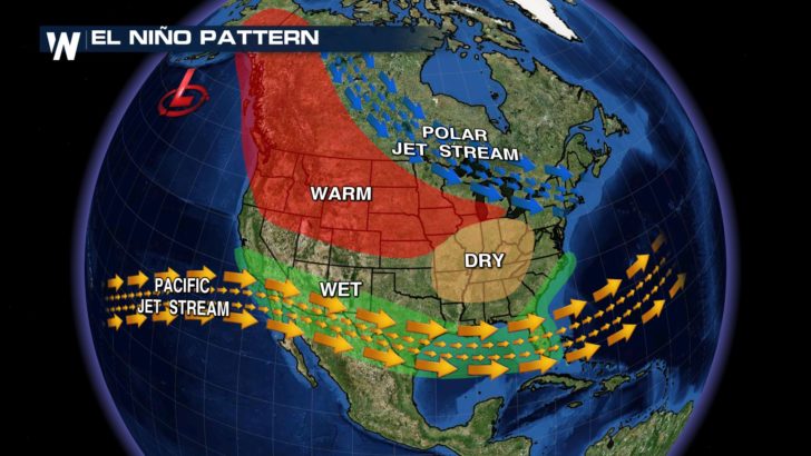
The CPC states that "During the fall and winter 2018-19, the temperature and precipitation outlooks are consistent with increasing odds of El Nino development and its typical influences, while also incorporating model output and trends." An El Nino watch was posted by NOAA in June, with the atmosphere already showing some signs of development in the July update.
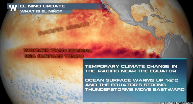
 El Nino (translated from Spanish as “little boy”) is a natural ocean-atmospheric phenomenon producing warmer-than-average sea surface temperatures in the central Pacific Ocean near the equator. It is usually marked by a warmer than average winter in the northern tier of the nation, with most of the southern sections of the country seeing above average precipitation.
 For WeatherNation: Meteorologist Mace Michaels
 El Nino (translated from Spanish as “little boy”) is a natural ocean-atmospheric phenomenon producing warmer-than-average sea surface temperatures in the central Pacific Ocean near the equator. It is usually marked by a warmer than average winter in the northern tier of the nation, with most of the southern sections of the country seeing above average precipitation.
 For WeatherNation: Meteorologist Mace Michaels
All Weather News
More