Milton Moves Toward Bermuda, Lingering Coastal Impacts in the Southeast

FLORIDA - Milton made landfall as a category 3 hurricane Wednesday evening in Siesta Key Florida. It proceeded to move across the state with hurricane force winds, knocking out power to over 3 million households while producing flooding rain and destructive storm surge. On Wednesday, Milton produced a record number of tornadoes for several regions.
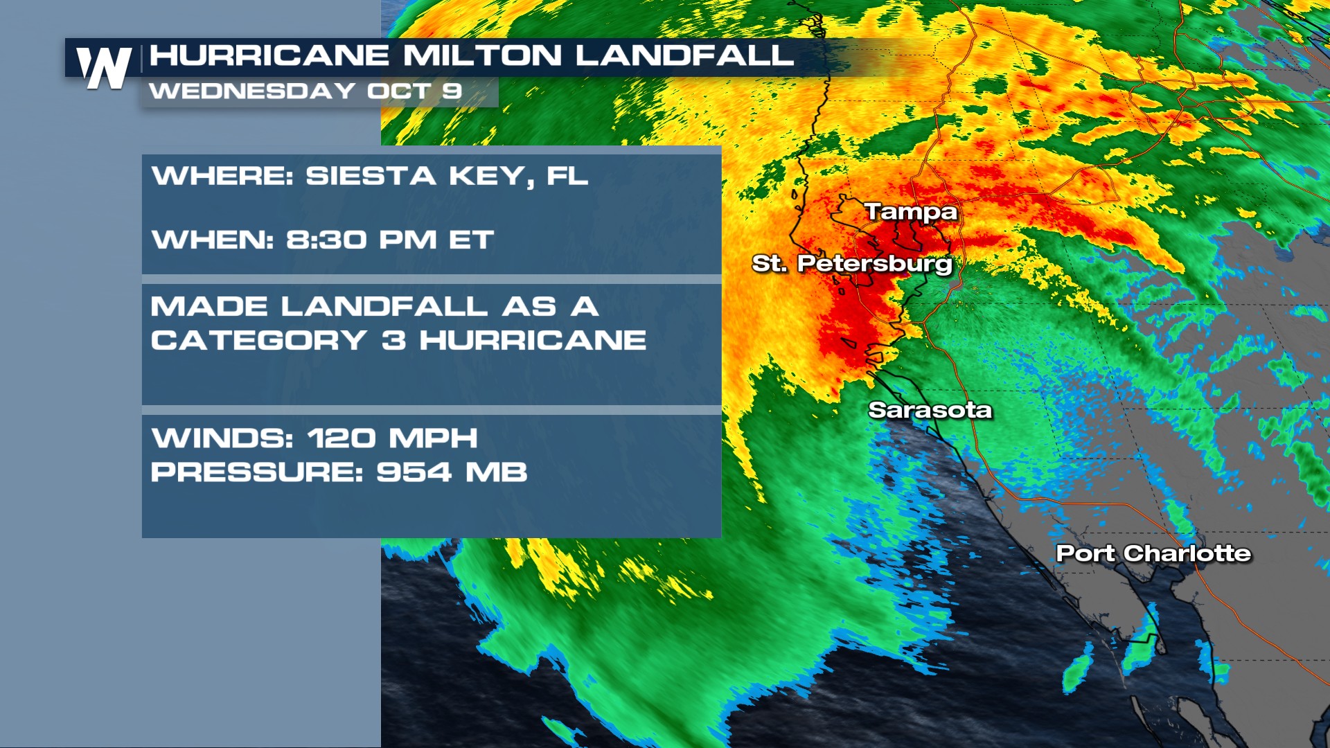
On Monday, the central pressure within Milton tumbled to a historically low level. The central pressure dropped to 897 millibars, which placed Milton as the 5th lowest pressure from an Atlantic named storm. Milton weakened somewhat as it approached the Florida Coastline, however the impacts remained strong.
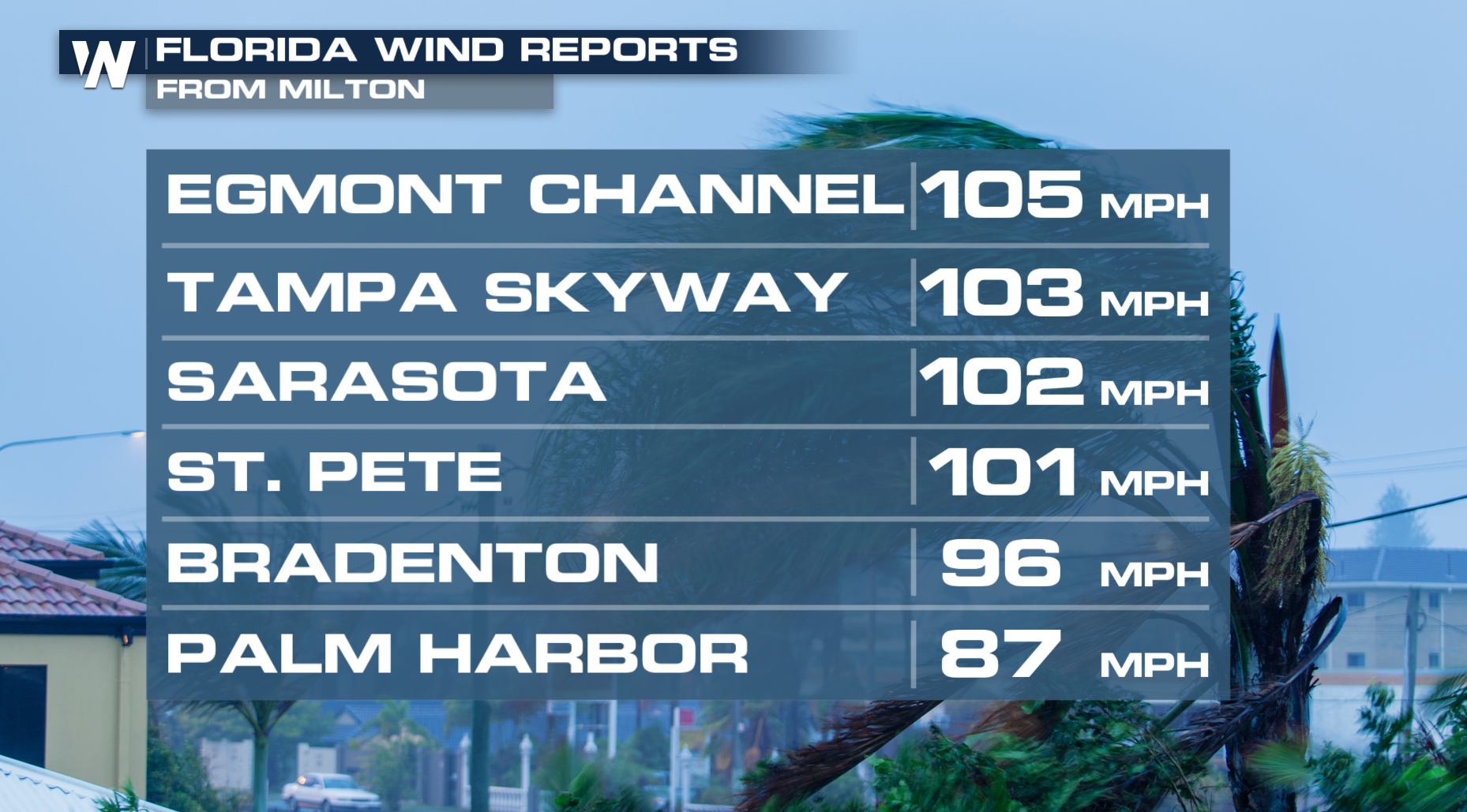
Wind Reports
According to the National Weather Service, a wind gust of 105 mph was clocked in Egmont Channel.
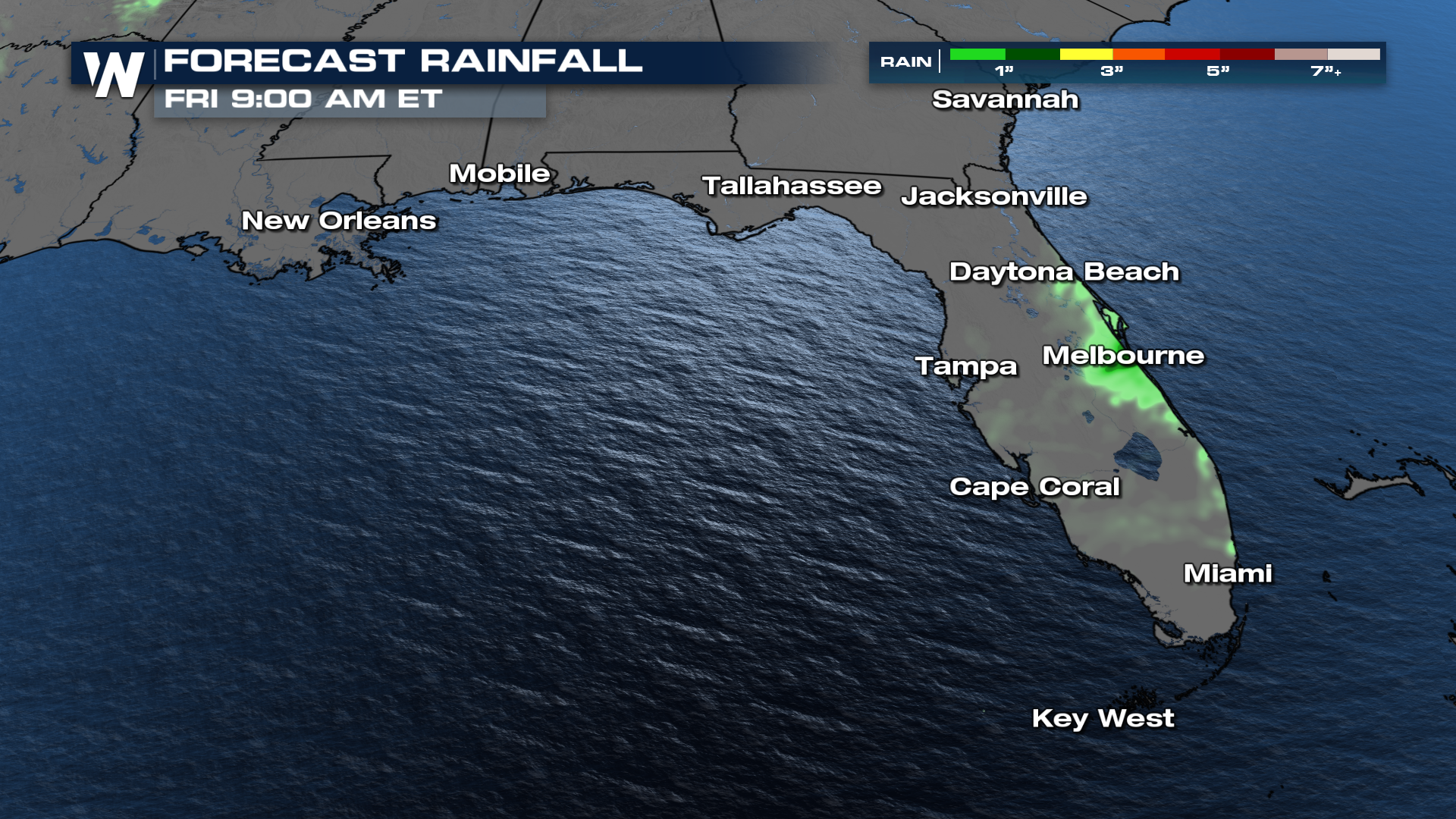
 Rain & Flooding Forecast
Rainfall amounts have topped 18" in some locations. The good news is that the heaviest rain has now moved into the Atlantic Ocean! A few off-and-on light to moderate showers will still be possible this evening across the Florida Atlantic Coast.